The best mountain hikes around Lodrino
4.5
(16)
157
hikers
4
hikes
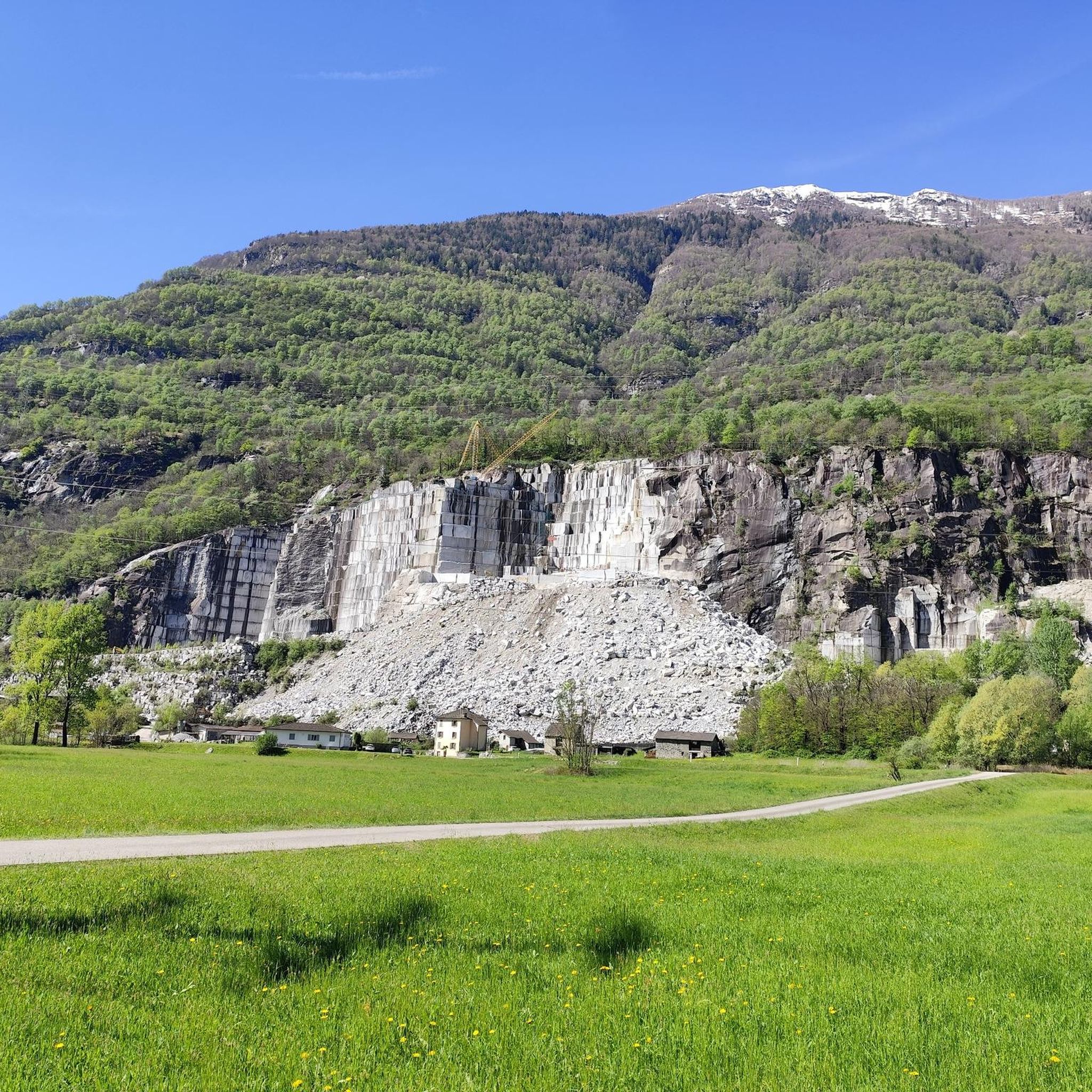
Mountaineering routes around Lodrino are primarily found in the Ticino region of Switzerland, characterized by dramatic mountainous terrain and deep gorges. The area features impressive rock faces, such as those within the Lodrino Gorge, and prominent peaks like the Sassariente Summit. This landscape offers challenging ascents and varied alpine environments for experienced mountaineers.
Best mountaineering routes around Lodrino
- The most popular mountaineering route is Pond with picnic benches loop from Circolo di Bellinzona, a 3.5 miles (5.6 km) trail that takes 2 hours 38 minutes to complete. This difficult route offers challenging terrain with significant elevation gain.
- Another top favourite among local mountaineers is Sassariente Summit Cross loop from Gordola, a difficult 5.9 miles (9.5 km) path. This route leads to the prominent Sassariente Summit, offering expansive views across the region.
- Local mountaineers also love the Pond with picnic benches – Capanna Albagno loop from Circolo di Bellinzona, a 6.4 miles (10.4 km) trail leading through mountainous terrain and past alpine huts, often completed in about 5 hours 39 minutes.
- Mountaineering around Lodrino is defined by dramatic gorges, prominent summits, and alpine valleys. The network offers options for experienced mountaineers seeking challenging ascents.
- The routes in Lodrino are highly rated by the komoot community with an average score of 4.2 stars from over 17 reviews. More than 160 mountaineers have used komoot to explore Lodrino's varied terrain.
Last updated: June 28, 2026
4.9
(14)
128
hikers
5.48km
02:35
440m
440m
Hard mountaineering route. Good fitness required. Sure-footedness, sturdy shoes and alpine experience required.
4.0
(2)
11
hikers
9.56km
04:28
690m
690m
Hard mountaineering route. Good fitness required. Sure-footedness, sturdy shoes and alpine experience required.

Sign up for free
16
hikers
Hard mountaineering route. Good fitness required. Sure-footedness, sturdy shoes and alpine experience required.
2
hikers
15.4km
07:26
1,160m
1,160m
Hard mountaineering route. Very good fitness required. Sure-footedness, sturdy shoes and alpine experience required.
Our route recommendations are based on thousands of hikes, rides, and runs completed by other people on komoot.
Start today with a free account
Your next adventure awaits.
Login or Signup
Tips from the Community

Perfect end after a hike for refreshments. Small menu with soup, polenta, risotto and homemade cake. https://www.montimotti.ch
0
0

Great picnic area with a fountain that has plenty of water, tables and benches
0
0
It's great that this cable car runs practically day and night. So you don't have to stress about catching the last descent while hiking. A little further down the road is the bus stop for the bus to Bellinzona Station.
0
0

very nicely hosted hut and great view over the valley deep below us
0
0
The exit of the via ferrata looks adventurous, as do the rocks behind it... but not this time...
0
0
Interestingly, as we pass by, there's an open toilet paper stand next to the table with a few dry rolls of toilet paper—it rarely seems to rain here...
0
0

a small hut with the possibility to eat and stay overnight....
0
0

The Cugnasco-Monti di Motti road was built as a military road during the First World War. After a 12 km climb on a narrow but well-maintained road, you reach Monti di Motti, a magnificent cluster of houses on a small lake with breathtaking views of the Verzasca Valley, the Magadino Plain, Monte Tamaro and Lake Maggiore. The grotto and the lake make this mountain an ideal destination for families who want to spend a day surrounded by nature. Several interesting excursions start from here, including one to the picturesque Sassariente
1
0
Frequently Asked Questions
How many mountaineering routes are available around Lodrino?
There are 7 challenging mountaineering routes around Lodrino, all rated as difficult. These routes are primarily located in the Ticino region of Switzerland, offering dramatic mountainous terrain for experienced mountaineers.
What kind of natural landmarks can I expect to see on mountaineering routes near Lodrino?
The region around Lodrino, particularly in the Swiss Ticino area, is rich in dramatic natural features. You can encounter impressive rock faces within the Lodrino Gorge, and prominent peaks like the Sassariente Summit, which offers expansive views. Other notable peaks include Vogorno Peak and Cima del Gaggio. You might also enjoy the view of Lago di Vogorno and Verzasca Dam from Mergoscia.
Are there any waterfalls or wild swimming spots near the mountaineering trails?
Yes, the area boasts several beautiful water features. The Verzasca River is known for its clear, turquoise waters, and you can find stunning waterfalls and boulder fields along its course. Other notable spots include the Santa Petronilla Falls and the Verzasca Waterfall near Corippo. The Gorge of the Iragna Stream also offers impressive scenery.
What is the best time of year for mountaineering in Lodrino?
The best time for mountaineering in Lodrino is typically from late spring through early autumn (May to October) when the weather is more stable and snow has largely receded from higher elevations. Always check local weather forecasts and trail conditions before heading out, especially for routes involving steep ascents or exposed sections.
Are there any circular mountaineering routes in the Lodrino area?
Yes, several mountaineering routes in Lodrino are designed as loops. For example, the Pond with picnic benches loop from Circolo di Bellinzona is a difficult 3.5-mile (5.6 km) trail. Another option is the Sassariente Summit Cross loop from Gordola, which is a challenging 5.9-mile (9.5 km) path offering expansive views.
What do other mountaineers enjoy most about the routes around Lodrino?
The mountaineering routes around Lodrino are highly rated by the komoot community, with an average score of 4.2 stars. Reviewers often praise the dramatic mountainous terrain, the challenging ascents, and the rewarding panoramic views from prominent peaks like the Sassariente Summit. The unique alpine environment and deep gorges are also frequently highlighted.
Are there any beginner-friendly mountaineering routes in Lodrino?
The mountaineering routes listed for Lodrino are all rated as difficult, indicating they are best suited for experienced mountaineers. These trails often involve significant elevation gain, steep sections, and potentially exposed terrain, requiring sure-footedness and alpine experience.
What are some of the more challenging alpine climbs or ridge routes in the area?
For those seeking advanced alpine challenges, the region offers routes like the Ridge Climbing in Ticino – Sassariente Summit Cross loop from Lavertezzo. The Sassariente Summit itself, while not extremely high, features a path that can be steep and unstable, equipped with chains and iron steps in certain sections, providing a true mountaineering experience.
Is public transport available to reach mountaineering trailheads in Lodrino?
While specific bus routes to individual trailheads can vary, public transport options exist within the Ticino region. It's advisable to check local bus schedules and connections from major hubs like Bellinzona or Gordola to villages closer to the trail starting points. Planning ahead is recommended as some trailheads might require a final short walk or taxi ride.
Are permits required for mountaineering or climbing in the Lodrino area of Switzerland?
Generally, permits are not required for hiking or mountaineering on established trails in the Swiss Alps. However, for specific climbing routes, especially via ferratas or more technical ascents, it's always best to check with local alpine clubs or tourist information centers for any specific regulations or safety guidelines. Canyoning in the Lodrino Gorge often requires guided tours or specific permits due to its technical nature.
Are there any mountain huts or refuges along the mountaineering routes?
Yes, the region offers mountain huts that can serve as a base or stop for hikers. For instance, the Pond with picnic benches – Capanna Albagno loop from Circolo di Bellinzona passes by alpine huts. In the Swiss Lodrino area, the Capanna Alpe d'Alva is an old renovated farmhouse serving as a hut with 24 beds, offering splendid views and a place to rest.
Can I find cafes or restaurants near the mountaineering trailheads in Lodrino?
While the immediate trailheads might be remote, you can find cafes, pubs, and restaurants in the nearby villages and towns. For example, Gordola, a starting point for some routes, offers amenities. It's always a good idea to pack sufficient food and water for your mountaineering trip, as services might not be directly on the trail.
Most popular routes around Lodrino
Most popular attractions around Lodrino

Get inspired with the komoot mobile app


Explore more
Browse the best Mountain Hikes & Routes in other regions.
