The best walks and hikes around La Fajolle
4.6
(1082)
8,293
hikers
174
hikes
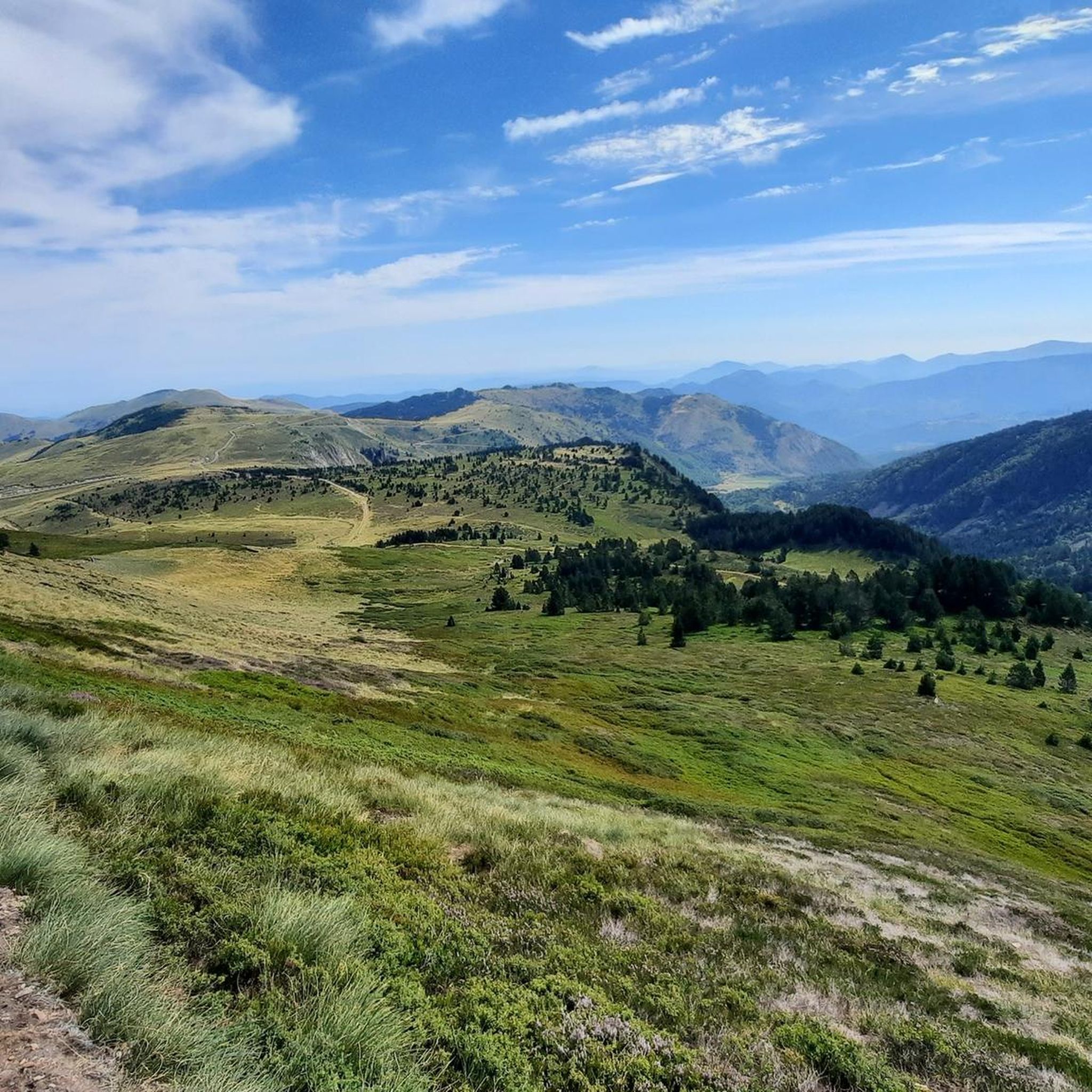
Hiking around La Fajolle offers access to a diverse Pyrenean landscape, transitioning from the Pays de Sault to the Gorges du Rébenty. The region features mountainous terrain with notable passes like Col de Pailhères and Col du Pradel, alongside picturesque lakes such as Étang de Pailhères and Étang de Rabassoles. Dense forests and dramatic gorges, including the Gorges de l'Aude, contribute to varied hiking environments.
Best hiking trails around La Fajolle
- The most popular hiking route is Le Pic de Tarbesou - loop starting from the Col de Pailhères car park, a 7.3 miles (11.7 km) trail that takes 4 hours 44 minutes to complete. This moderate route features a 600m elevation gain.
- Another top favourite among local hikers is Pic de Tarbesou – Étang de Pailhères loop from Port de Pailhères, a moderate 5.7 miles (9.2 km) path. This trail involves a 520m elevation gain and offers views of the Étang de Pailhères.
- Local hikers also love the Pic de Tarbesou – Coumeille de l'Ours Pass loop from Port de Pailhères, a 3.3 miles (5.3 km) trail leading through mountainous terrain, often completed in about 2 hours 18 minutes.
- Hiking around La Fajolle is defined by mountain passes, serene lakes, and diverse forests and gorges. The network offers options for different ability levels, from easy walks to more strenuous hikes.
- The routes in La Fajolle are highly rated by the komoot community with an average score of 4.6 stars from over 900 reviews. More than 7000 hikers have used komoot to explore La Fajolle's varied terrain.
Last updated: August 28, 2026
4.8
(111)
1,016
hikers
11.7km
04:45
600m
600m
Moderate hike. Good fitness required. Mostly accessible paths. Sure-footedness required.
4.7
(59)
363
hikers
10.3km
04:28
690m
690m
Moderate hike. Good fitness required. Mostly accessible paths. Sure-footedness required.

Sign up for free
4.7
(13)
116
hikers
Moderate hike. Good fitness required. Mostly accessible paths. Sure-footedness required.
5.0
(1)
29
hikers
15.4km
05:26
790m
790m
Hard hike. Very good fitness required. Mostly accessible paths. Sure-footedness required.
5.0
(2)
20
hikers
16.8km
06:54
1,000m
1,000m
Hard hike. Very good fitness required. Mostly accessible paths. Sure-footedness required.
Get access to more routes and recommendations from other explorers.
Sign up for free
Already have an account?
Our route recommendations are based on thousands of hikes, rides, and runs completed by other people on komoot.
Start today with a free account
Your next adventure awaits.
Login or Signup

Other adventures around La Fajolle

Tips from the Community

Magnificent landscape at the summit of the peak. Pretty flower and some horses Nice hike don't forget to drink... water
1
0

The setting here is truly stunning. The Rabassoles ponds shine in the valley, standing out against the surrounding granite cliffs. You can see the Rabassoles pond (1,851 metres), the Blue pond (1,920 metres) and the Black pond (1,970 metres).
2
0

When you hike up to this view of the Etang Bleu, you are rewarded with a breathtaking sight where the bright blue waters of the pond are nestled among the rugged peaks of the Pyrenees. The Etang Bleu, known for its deep blue and strikingly clear waters, is surrounded by lush vegetation and rocky outcrops, creating a tranquil and almost magical atmosphere. You can take advantage of this peaceful spot to take a break and soak up the natural beauty of the area before continuing your exploration of the nearby Etang de Rabassoles and its equally captivating landscape.
2
0

gorgeous view! and the way from there down to the lakes is definitely worth securing.
2
1


The peak of Tarbésou, which culminates at 2,364 meters and overlooks the ponds of Rabassoles, offers a magnificent belvedere.
3
0
The ascent of the Tarbésou peak offers magnificent views of the Rabassoles ponds.
1
0
The Rabassoles ponds form a magnificent set of three ponds: the Rabassoles pond, the Blue pond and the Black pond.
0
0
Frequently Asked Questions
How many hiking trails are available in La Fajolle?
La Fajolle offers a wide variety of hiking experiences, with over 160 routes available. These range from easy strolls to more challenging mountain ascents, catering to all skill levels.
What kind of terrain can I expect on hikes around La Fajolle?
The terrain around La Fajolle is incredibly diverse, transitioning from the mountainous landscapes of the Pyrenees to the dramatic gorges of the Rébenty. You'll encounter impressive peaks, serene lakes like the Rabassoles ponds, and dense forests, particularly beautiful with their vibrant beeches in autumn. Many routes involve significant elevation changes, characteristic of a mountain environment.
Are there any easy or family-friendly hiking options in La Fajolle?
Yes, La Fajolle has a good selection of easier trails suitable for families. Out of the over 160 routes, 40 are classified as easy. While specific family-friendly routes aren't detailed here, these easier options generally feature less elevation gain and shorter distances, making them ideal for a relaxed outing.
Can I bring my dog on the hiking trails in La Fajolle?
The region around La Fajolle is generally welcoming to dogs, but it's always best to keep them on a leash, especially in areas with livestock or protected wildlife. Given the presence of diverse wildlife and an ongoing project to establish a National Nature Reserve, responsible pet ownership is crucial to protect the natural environment.
What natural features or landmarks can I see while hiking in La Fajolle?
Hiking in La Fajolle allows you to discover a wealth of natural beauty. You can explore picturesque water bodies like the Viewpoints over the Rabassoles ponds and the View of Étang Bleu. The region is also home to impressive peaks such as Pic de Tarbesou and the Pailhères Pass, offering stunning panoramic views. The area is also known for its extensive forests and narrow gorges.
Are there any circular hiking routes in La Fajolle?
Yes, many of the most popular hikes in La Fajolle are circular routes, allowing you to experience diverse landscapes without retracing your steps. For example, the route Le Pic de Tarbesou - loop starting from the Col de Pailhères car park is a moderate 11.7 km loop, and the View of the Étang de Rabassoles – Étang de Pailhères loop from Port de Pailhères offers another scenic circular option.
What is the best time of year to go hiking in La Fajolle?
The best time to hike in La Fajolle largely depends on your preferences. Spring and summer offer pleasant temperatures and lush greenery, ideal for enjoying the lakes and mountain passes. Autumn is particularly stunning, as the extensive beech forests transform with vibrant colors. While winter hiking is possible, be prepared for snow and colder conditions, especially at higher elevations.
Are there options for more challenging hikes in the region?
Absolutely. La Fajolle is situated in a mountainous region bordering the Pyrenees, offering plenty of challenging routes for experienced trekkers. There are 32 routes classified as difficult, featuring significant elevation gains and longer distances. Ascents to peaks like Pic de Tarbesou often involve substantial climbs and can take several hours to complete.
What do other hikers say about their experience in La Fajolle?
The hiking trails in La Fajolle are highly regarded by the komoot community, with an impressive average rating of 4.6 stars from over 900 reviews. Hikers frequently praise the diverse and striking landscapes, the well-defined trails, and the opportunity to experience the region's natural beauty, from panoramic mountain views to serene ponds and dense forests.
How can I reach the trailheads around La Fajolle using public transport?
While La Fajolle is a mountain village, public transport options to specific trailheads can be limited. It's advisable to check local bus schedules for services to nearby towns or key access points like the Col de Pailhères, which serves as a starting point for several popular loops. For ultimate flexibility, driving to the trailheads is often the most convenient option.
Are there any specific regulations or permits needed for hiking in La Fajolle?
Currently, there are no general permits required for hiking in La Fajolle. However, the region is a sensitive natural territory with an ongoing project to establish a National Nature Reserve. Hikers are encouraged to follow Leave No Trace principles, respect local wildlife, and stay on marked trails to help preserve this beautiful environment.
Are there any hikes that offer particularly good viewpoints?
Many hikes in La Fajolle provide spectacular viewpoints, especially those ascending to higher elevations. The Pic de Tarbesou is renowned for its panoramic vistas. Additionally, the Pierre Blanche Pass is noted as a viewpoint, and routes around the Col de Pailhères often offer expansive views of the surrounding mountains and valleys.
Most popular routes around La Fajolle
Most popular attractions around La Fajolle

Get inspired with the komoot mobile app


Explore more
Browse the best Hikes in other regions.
