The best mountain hikes around Diepoldsau
4.8
(70)
588
hikers
53
hikes
Mountaineering routes around Diepoldsau are characterized by the alpine foothills of the Wahlkreis Rheintal, offering a diverse landscape for challenging ascents. The region features prominent summits, cliffside trails, and dense woodlands, providing varied terrain for experienced mountaineers. These routes often include significant elevation gains and technical sections, typical of the mountainous environment.
Best mountaineering routes around Diepoldsau
- The most popular mountaineering route is Kapfweg Cliffside Staircase – Kapf Summit Cross loop from Götzis, a 5.1 miles (8.2 km) trail…
Last updated: May 27, 2026
4.5
(4)
24
hikers
8.11km
03:32
590m
590m
Hard mountaineering route. Good fitness required. Sure-footedness, sturdy shoes and alpine experience required.
5.0
(6)
16
hikers
16.7km
07:38
1,230m
1,230m
Hard mountaineering route. Very good fitness required. Sure-footedness, sturdy shoes and alpine experience required.

Sign up for free
5.0
(1)
18
hikers
10.8km
04:09
630m
630m
Hard mountaineering route. Good fitness required. Sure-footedness, sturdy shoes and alpine experience required.
5.0
(2)
15
hikers
6.23km
02:30
470m
470m
Moderate mountaineering route. Good fitness required. Mostly accessible paths. Sure-footedness required.
5.0
(1)
7
hikers
13.1km
05:08
770m
770m
Hard mountaineering route. Very good fitness required. Sure-footedness, sturdy shoes and alpine experience required.
Get access to more routes and recommendations from other explorers.
Sign up for free
Already have an account?
Our route recommendations are based on thousands of hikes, rides, and runs completed by other people on komoot.
Start today with a free account
Your next adventure awaits.
Login or Signup
Tips from the Community

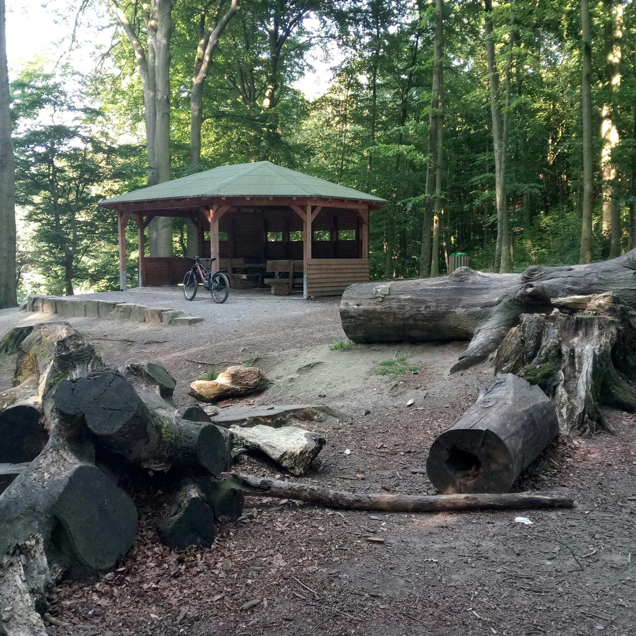
Great Alp with terrace, definitely worth a visit.
8
0
What a view from the Kapf, 1153 m above sea level. The Kapf is a 1153 m high mountain in the Bregenzerwald Mountains. It is located near the town of Hohenems. From the summit, there are views of the Rhine Valley and Lake Constance. It is located in the Hohe Kugel - Hoher Freschen - Mellental nature reserve. Source: https://de.m.wikipedia.org/wiki/Kapf_(Bregenzerwaldgebirge)
9
0
The Witeleloch was first described in a newspaper article around 1907 by archaeologist and amateur geologist Gero von Merhart, who used the name Elisabethhöhle. In 1922, the cave was described by Josef Blumrich, a teacher from Bregenz. The cave has been designated a geological natural monument since April 1979. Source: https://de.m.wikipedia.org/wiki/Witeleloch
8
0

The world-class nut peaks are ONLY available up there, because they are a special production ‼️
0
0
The nut peaks in Gsohl are world class and because they are a special production, they are ONLY available there ‼️
1
0

Always a great destination with a great view over the Rhine Valley 🥰
3
0
Great hut with a beautiful view of the Rhine Valley. Definitely worth a visit 😉.
5
0
Frequently Asked Questions
How many mountaineering routes are available around Diepoldsau?
There are over 50 mountaineering routes around Diepoldsau, offering a wide range of experiences. The majority, 41 routes, are classified as difficult, with 14 moderate options also available.
Are there any moderate mountaineering routes suitable for those with less experience?
Yes, while many routes are challenging, there are 14 moderate mountaineering options around Diepoldsau. One such route is the Spallenhof Beer Tap – Via Kapf via ferrata loop from Spallenhof, which offers a less strenuous experience compared to the more difficult ascents.
What is the typical duration for mountaineering routes in the Diepoldsau region?
The duration of mountaineering routes around Diepoldsau varies significantly depending on the trail's length and difficulty. For example, the Kapfweg Cliffside Staircase – Kapf Summit Cross loop from Götzis typically takes around 3 hours 35 minutes, while the longer Hohe Kugel Summit (1,645 m) – Emser Hut loop from Hohenems can take over 7 hours to complete.
What kind of terrain and features can I expect on mountaineering routes near Diepoldsau?
Mountaineering routes near Diepoldsau are characterized by the alpine foothills of the Wahlkreis Rheintal. You can expect significant elevation gains, prominent summits, cliffside trails, and dense woodlands. Some routes, like the Kapfweg Cliffside Staircase – Kapf Summit Cross loop from Götzis, even feature notable cliffside staircases.
What do other mountaineers enjoy most about the routes in Diepoldsau?
The mountaineering routes in Diepoldsau are highly rated by the komoot community, with an average score of 4.8 stars from over 60 reviews. Mountaineers often praise the varied terrain, challenging ascents, and the rewarding views from prominent summits.
Are there any circular mountaineering routes available?
Yes, many mountaineering routes around Diepoldsau are designed as circular loops, allowing you to start and finish at the same point. Examples include the Bepposteig – Emsbach Trail loop from Hohenems and the Bremaries Trail – Emsbach Trail loop from Hohenems.
What are some interesting natural attractions or landmarks near the mountaineering routes?
Beyond the trails themselves, the region offers several natural attractions. You can explore the dramatic Rappenloch Gorge or the serene Alploch Gorge. These natural wonders provide additional points of interest for your trip.
Is it possible to find less crowded mountaineering routes around Diepoldsau?
While some popular routes can see more traffic, the region offers a good number of trails. To find less crowded options, consider exploring some of the 41 difficult routes that might be less frequented, or choose to hike during off-peak hours or seasons. The sheer number of routes provides opportunities to discover quieter paths.
What is the best time of year for mountaineering in Diepoldsau?
The best time for mountaineering in Diepoldsau is typically from late spring through early autumn (May to October) when the weather is generally more stable and trails are free of snow. However, conditions can vary, so always check local weather forecasts and trail conditions before heading out, especially at higher elevations.
Are there any historical or cultural points of interest near the mountaineering trails?
Yes, the area around Diepoldsau has some interesting historical elements. You might encounter the Old Rhine Border Crossing Switzerland–Austria, which offers a glimpse into the region's past. Additionally, the Covered wooden bridge over the Dornbirner Ache is a charming historical structure.
What should I consider regarding weather and gear for mountaineering in Diepoldsau?
Given the mountainous terrain, weather conditions can change rapidly. Always pack layers, waterproof and windproof outer shells, sturdy hiking boots, and sufficient water and snacks. For more challenging routes, consider bringing a map, compass or GPS device, and a first-aid kit. Checking the local mountain weather forecast before your ascent is crucial.
Most popular routes around Diepoldsau
Most popular attractions around Diepoldsau

Get inspired with the komoot mobile app


Explore more
Browse the best Mountain Hikes & Routes in other regions.
