The best walks and hikes around Moïta
4.4
(720)
2,611
hikers
51
hikes
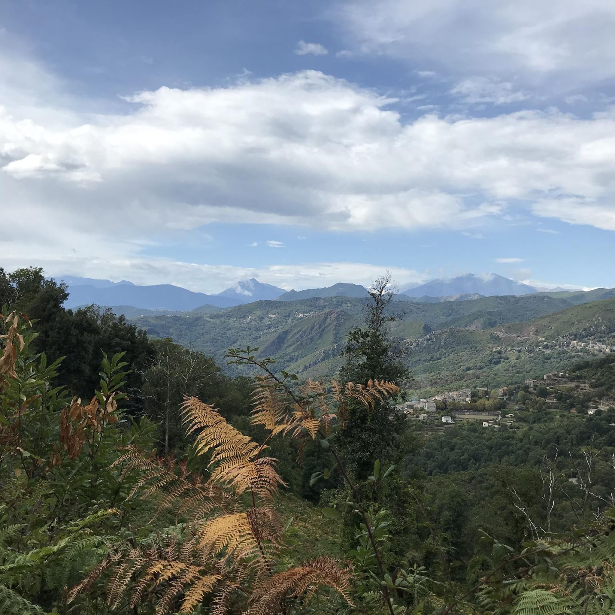
Hiking trails around Moïta are situated in Corsica's mountainous interior, a region characterized by diverse natural landscapes. The area features jagged ridges, deep valleys, and extensive forests, including chestnut groves and thick maquis. Elevated points offer panoramic views of the Corsican mountains, extending towards Monte Cardo and the Aiguilles de Bavella. Natural water features, such as the Bravone river and various cascades, are also present.
Best hiking trails around Moïta
- The most popular hiking route is Chiatra loop from Chiatra…
Last updated: June 28, 2026
4.4
(15)
58
hikers
2.57km
00:54
70m
70m
Moderate hike. Great for any fitness level. Mostly accessible paths. Sure-footedness required.
4.0
(1)
15
hikers
12.7km
04:49
680m
680m
Moderate hike. Good fitness required. Mostly accessible paths. Sure-footedness required.

Sign up for free
4.0
(3)
8
hikers
8.98km
03:13
420m
430m
Moderate hike. Good fitness required. Mostly accessible paths. Sure-footedness required.
4.6
(5)
6
hikers
7.13km
02:50
530m
530m
Moderate hike. Good fitness required. Easily-accessible paths. Suitable for all skill levels.
4.0
(3)
10
hikers
8.99km
03:12
440m
430m
Moderate hike. Good fitness required. Mostly accessible paths. Sure-footedness required.
Get access to more routes and recommendations from other explorers.
Sign up for free
Already have an account?
Our route recommendations are based on thousands of hikes, rides, and runs completed by other people on komoot.
Start today with a free account
Your next adventure awaits.
Login or Signup
Tips from the Community

former Franciscan monastery, center of Corsican resistance in the 18th century, with the magnificently renovated monastery church. The jazz and other concerts there are beautiful
0
0

Located at 820 meters above sea level, Pianello is made up of a total of four hamlets. In the heart of the Bravone valley, the village benefits from a remarkable natural environment. Notably its centuries-old chestnut grove at the entrance to the village or the Bravone waterfall.
0
0


Nice hike - there is just the passage below Perelli which is not well marked and not pleasant (path not well maintained).
0
0

Pianellu is a wonderful village with very welcoming inhabitants. Particularly, I recommend this gîte, the cooking is amazing and tue view is stunning overlooking the sea from the mountains…
0
0


Go at the village square towards the church. At the top is a hidden, phenomenal vantage point. Unfortunately we drove over here for 10 years.
1
0
Walk at the church quite high, 23 ° slope. Above is a platform. There you will be rewarded with a phenomenal view over the valley and out to sea with the islands of Elba and Montecritso.
1
0
Frequently Asked Questions
What kind of terrain can I expect on hikes around Moïta?
Hiking around Moïta offers a diverse landscape, characterized by Corsica's mountainous interior. You'll encounter jagged ridges, deep valleys, and extensive forests, including chestnut groves and thick maquis. Trails can range from steep paths to more gentle ascents, often providing varied terrain within a single route.
Are there any easy hiking trails suitable for beginners or families in Moïta?
Yes, Moïta offers several easy hiking trails. For example, the View of Pianello – Pianellu and its wonderful gite loop from Pianello is an easy 5.1 km route that provides a good introduction to the area's beauty without significant challenge. Overall, there are 11 easy routes available in the region.
Can I find circular hiking routes near Moïta?
Absolutely. Many trails around Moïta are designed as loops, allowing you to start and end in the same location. Popular circular options include the Chiatra loop from Chiatra, a moderate 2.6 km trail, and the longer Pianellu and its wonderful gite loop from Pianello, which covers 12.7 km. Another option is the Ferriera Bridge – Couvent d'Alisgiani loop from Ortale, a 9 km route.
What natural features or landmarks can I see along the hiking trails?
The Moïta region is rich in natural and historical landmarks. You might encounter natural water features like the Bravone river, which is crossed by an authentic Genoese bridge on routes such as the Sentier Zalana-Matra. Other notable natural attractions include the Struccia Waterfall and various springs. For stunning vistas, look for viewpoints like the Beautiful view below the Pointe de Sambuco, offering panoramic views of the Corsican mountains.
Are there any historical sites or cultural points of interest to explore?
Yes, the region around Moïta has historical elements integrated into its landscape. You can find ancient structures like the Ferriera Bridge, which is part of the Ferriera Bridge – Couvent d'Alisgiani loop from Ortale. Trails may also pass through charming old villages, offering a glimpse into Corsican history and culture. The Way of the Cross of Cervione and the Notre-Dame-de-Scupiccia Chapel are also nearby points of interest.
What do other hikers enjoy the most about hiking in Moïta?
The hiking trails in Moïta are highly regarded by the komoot community, with an average rating of 4.5 stars from over 700 reviews. Hikers frequently praise the region's diverse natural landscapes, the stunning panoramic views of the Corsican mountains, and the opportunity to explore both challenging and easy routes through forests and valleys.
What is the best season to go hiking in Moïta?
Corsica, including the Moïta region, generally offers pleasant hiking conditions from spring through autumn. Spring brings blooming wildflowers and milder temperatures, while autumn provides cooler weather and beautiful foliage. Summer can be warm, especially at lower altitudes, so early morning or late afternoon hikes are often preferred during this season. Always check local weather forecasts before heading out.
Are there any hikes with particularly good viewpoints in the Moïta area?
Many trails in the Moïta region offer breathtaking panoramic views due to its mountainous terrain. Elevated points often provide vistas of the Corsican mountains, extending towards Monte Cardo and the distant Aiguilles de Bavella. From certain spots, like the Pointe de l'Orsaja, you can even catch glimpses of the Costa Verde beaches. The Pianellu and its wonderful gite loop from Pianello is known for its extensive views of the surrounding region.
Is public transport available to reach hiking trailheads near Moïta?
While Moïta is a village nestled in Corsica's interior, public transport options directly to specific trailheads can be limited. It's advisable to research local bus services or consider renting a car for greater flexibility in accessing the various hiking routes around the region. For general information on transport in Corsica, you might find resources on visit-corsica.com helpful, though specific trailhead access may require local inquiry.
Are there places to eat or stay in Moïta or nearby for hikers?
Moïta, as a village, offers some local amenities. While specific cafes, pubs, or restaurants directly on trailheads might be rare, you can typically find options within Moïta itself or in nearby villages. The Pianellu and its wonderful gite loop from Pianello even mentions a 'wonderful gite' (a type of rural lodging), indicating accommodation options exist. For more information on Moïta's local offerings, you can check resources like tourisme-oriente.corsica.
Are dogs allowed on the hiking trails around Moïta?
Generally, dogs are permitted on many hiking trails in Corsica, especially in less protected areas. However, specific rules can vary, particularly within national parks or nature reserves. It's always best to keep dogs on a leash to protect local wildlife and ensure the safety of other hikers. Always check local signage at trailheads for any specific restrictions or requirements regarding pets.
How many hiking trails are available in the Moïta region?
There are over 50 hiking trails available in the Moïta region, catering to various difficulty levels. This includes 11 easy routes, 30 moderate routes, and 11 difficult routes, ensuring options for every type of hiker.
What is the typical duration for a hike in Moïta?
Hiking durations in Moïta vary widely depending on the trail's length and difficulty. Shorter, easy loops like the Chiatra loop from Chiatra can be completed in under an hour. Moderate routes, such as the Figure-eight knot loop from Tox (7.1 km), typically take around 3 hours. Longer, more challenging trails can extend to half-day or full-day excursions.
Most popular attractions around Moïta

Get inspired with the komoot mobile app


Explore more
Browse the best Hikes in other regions.
