The best running trails around Montner
4.4
(75)
1,861
runners
170
runs
Jogging around Montner offers a diverse environment for outdoor enthusiasts. The region is characterized by vineyards and arid hills, providing a scenic backdrop for running routes with varied terrain. The broader Fenouillèdes area features a combination of mountains and verdant valleys, creating a network of paths ranging from mostly paved surfaces to more rugged trails. Unique geological formations like the "Organ Pipes of Ille-sur-Têt" are also found nearby, adding to the natural features of the landscape.
Best jogging routes around Montner
- The most popular jogging route is Descent of the Força Réal loop from Montner, a 5.5 miles (8.9 km) trail that takes 1 hour 7 minutes to complete. This difficult route includes significant elevation gain towards Força Réal, offering panoramic views.
- Another top favourite among local runners is Força Real loop from Col de la Bataille, a moderate 5.2 miles (8.4 km) path. This running route provides varied terrain and vistas from the Col de la Bataille.
- Local runners also love the Descent of the Força Réal loop from Col de la Bataille, a 4.3 miles (6.9 km) trail leading through the hills surrounding Força Réal, often completed in about 50 minutes.
- Jogging around Montner is defined by vineyards, arid hills, and the distinctive "fairy chimneys" geological formations. The network of running routes offers options for easy, moderate, and difficult ability levels.
- The routes in Montner are highly rated by the komoot community with an average score of 4.4 stars from over 70 reviews. More than 1900 runners have used komoot to explore Montner's varied terrain.
Last updated: May 17, 2026
5.0
(1)
21
runners
10.5km
01:19
370m
370m
Hard run. Very good fitness required. Mostly paved surfaces. Suitable for all skill levels.
5.0
(4)
7
runners
8.41km
01:03
280m
280m
Moderate run. Good fitness required. Mostly paved surfaces. Suitable for all skill levels.

Sign up for free
5.0
(6)
7
runners
6.87km
00:50
210m
210m
Moderate run. Good fitness required. Mostly paved surfaces. Suitable for all skill levels.
7
runners
4.57km
00:29
70m
70m
Easy run. Great for any fitness level. Mostly paved surfaces. Suitable for all skill levels.
5
runners
5.84km
00:41
130m
130m
Moderate run. Good fitness required. Mostly paved surfaces. Suitable for all skill levels.
Get access to more routes and recommendations from other explorers.
Sign up for free
Already have an account?
Our route recommendations are based on thousands of hikes, rides, and runs completed by other people on komoot.
Start today with a free account
Your next adventure awaits.
Login or Signup

Tips from the Community

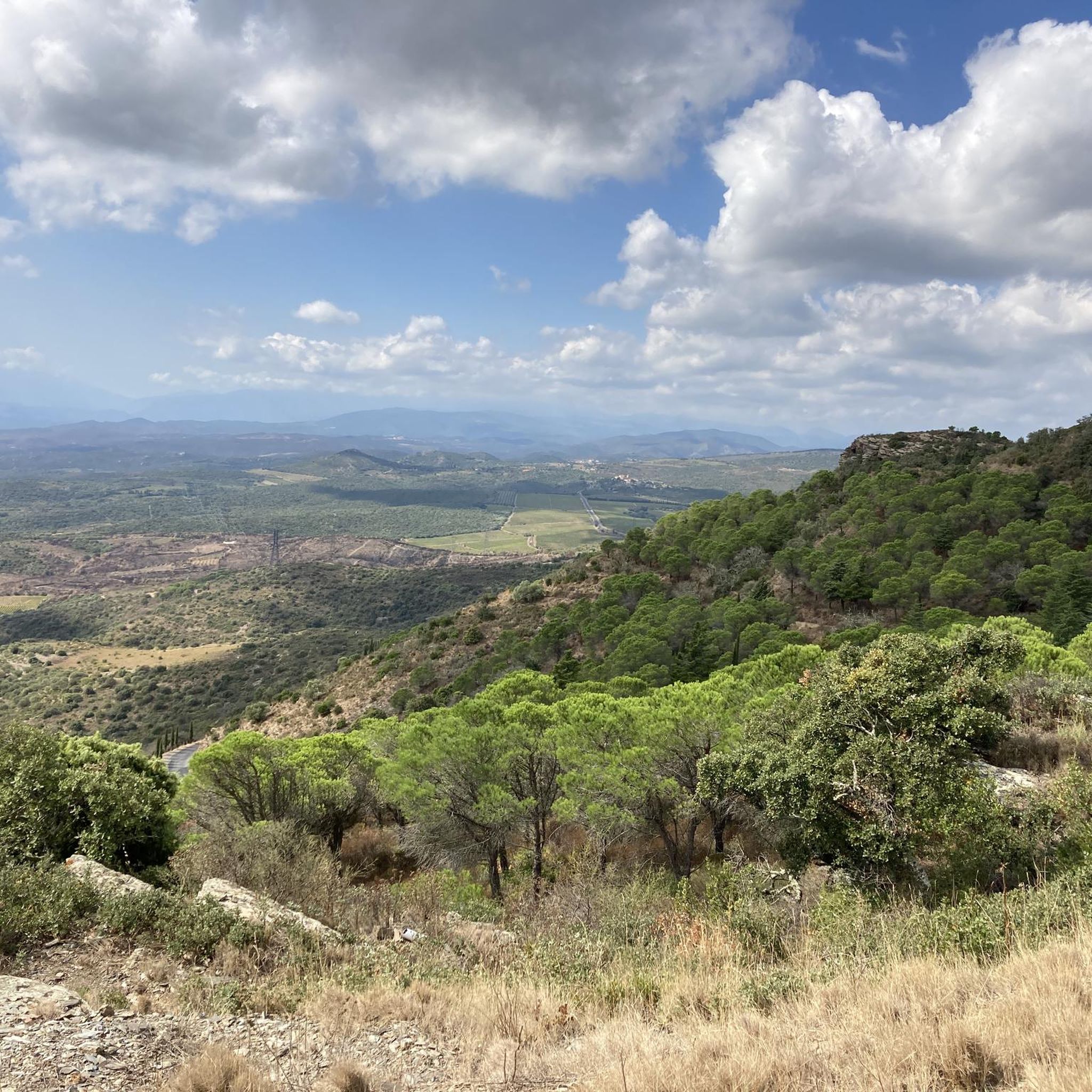
Super view and superb MTB descent on a singletrack.
0
0

Superb sunrise bike ride. 1st in Perpignan in 2022
0
0


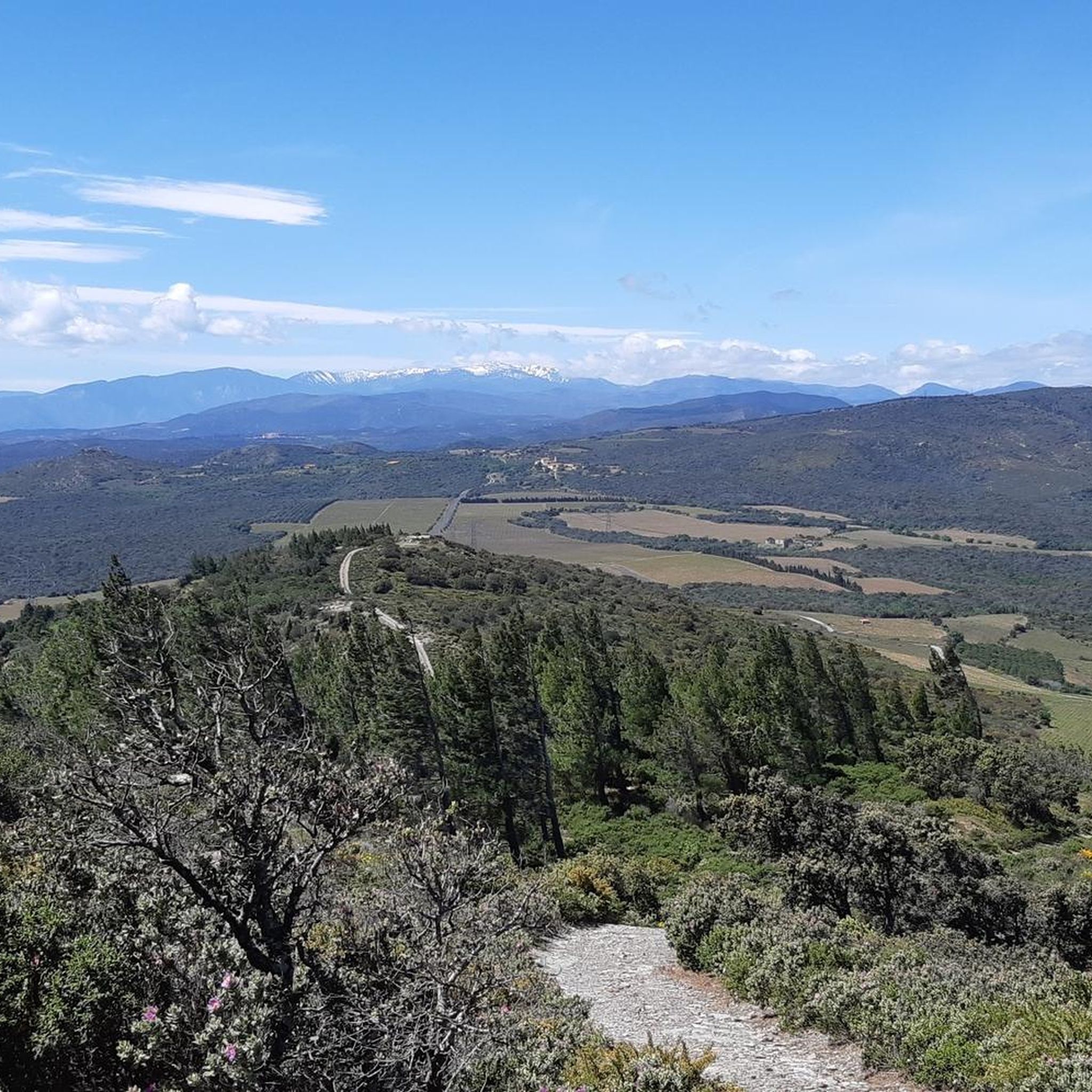
Gigantic panoramic view that can only be described as breathtaking; an absolute recommendation.
3
0


Very striking, although not particularly high, Pyrenees peak, whose 360 degree panorama is unique. The name comes from a former fortress of the kings of Mallorca (Fort Réal), of which nothing remains.
0
0


Wide and smooth descent for all levels
0
0
Frequently Asked Questions
How many running routes are available around Montner?
Montner and its surroundings offer a wide selection of running paths, with over 160 routes available. These range in difficulty from easy to difficult, ensuring options for all fitness levels.
What kind of terrain can I expect on the jogging trails near Montner?
The jogging trails around Montner feature diverse terrain. You'll find paths winding through picturesque vineyards and arid hills, offering a mix of gentle undulations and more challenging inclines. Some routes include mostly paved surfaces, while others venture onto rugged trails that may require sure-footedness and sturdy shoes.
Are there any easy running routes suitable for beginners in Montner?
Yes, Montner offers several easy running routes perfect for beginners or those looking for a less strenuous jog. For example, the Running loop from Montner is an easy 4.7 km path with minimal elevation gain, typically completed in about 30 minutes.
What are some notable landmarks or scenic viewpoints I can see while jogging in Montner?
Montner's routes offer stunning views and interesting landmarks. You can enjoy panoramic vistas from elevated points like those near Notre-Dame de Força Réal Chapel, which often include the majestic Pic du Canigou. The unique geological formations known as the Organ Pipes of Ille-sur-Têt are also in the vicinity, offering a distinctive natural spectacle.
Are there any circular running routes in the Montner area?
Yes, many of the running routes around Montner are circular, allowing you to start and finish in the same location. A popular option is the Força Real loop from Col de la Bataille, a moderate 8.4 km path that provides varied terrain and vistas.
What do other runners enjoy most about jogging in Montner?
The running routes in Montner are highly rated by the komoot community, with an average score of 4.4 stars from over 70 reviews. Runners often praise the diverse terrain, the scenic beauty of the vineyards and hills, and the rewarding panoramic views from higher elevations.
Is Montner a good place for family-friendly jogging or walks?
Montner offers routes suitable for various abilities, including easier paths that can be enjoyed by families. While some trails involve significant elevation, there are also less demanding options, particularly those with more paved surfaces, that are great for a family outing. Always check the route's difficulty and length to ensure it matches your family's capabilities.
Are the jogging trails around Montner dog-friendly?
Generally, the natural trails and paths around Montner are suitable for dogs, especially given the region's unspoilt nature. However, it's always advisable to keep your dog on a leash, especially when passing through vineyards or near livestock, and to check for any specific local regulations or signage on individual routes.
What is the best time of year to go running in Montner?
Montner offers a pleasant environment for running throughout much of the year. Spring and autumn provide mild temperatures and beautiful scenery, making them ideal. Summers can be hot, so early morning or late afternoon runs are recommended. Winters are generally mild, but checking local weather conditions is always a good idea.
Are there options for parking or public transport access to the running routes in Montner?
Montner is a small village, and parking is typically available within or near the village center, providing access to many routes. For specific public transport options to Montner or trailheads, it's best to consult local transport schedules as services can be limited in rural areas.
Can I find cafes or amenities near the running trails in Montner?
Montner village itself offers some amenities, including local cafes or shops where you can refuel or relax after your run. Many routes start or pass through the village, making it convenient to access these facilities. The region is also known for its cooperative wineries, which can be interesting to explore.
How do the running routes in Montner compare to those in nearby villages?
Montner's running routes are distinctive due to their immediate proximity to vineyards and arid hills, offering a unique sensory experience. While nearby villages in the Fenouillèdes region also boast diverse landscapes, Montner specifically provides excellent access to the Força Réal area with its significant elevation gains and panoramic views, making it a prime spot for varied running challenges.
Most popular attractions around Montner

Get inspired with the komoot mobile app


Explore more
Browse the best Running Trails & Routes in other regions.
