The best walks and hikes around Montépilloy
4.6
(248)
1,323
hikers
172
hikes
Hiking around Montépilloy offers diverse landscapes within the Valois plain, characterized by generally easy terrain and open vistas. The region is part of the Oise-Pays de France Regional Natural Park, providing a protected natural environment. Forests, such as the nearby Ermenonville Forest, contribute to the area's natural appeal. The presence of sandy soil ensures comfortable hiking conditions throughout the year.
Best hiking trails around Montépilloy
- The most popular hiking route is Montépilloy Castle loop from Montépilloy, a 6.2 miles…
Last updated: July 5, 2026
4.1
(8)
25
hikers
Moderate hike. Good fitness required. Mostly accessible paths. Sure-footedness required.
4.5
(2)
10
hikers
Moderate hike. Good fitness required. Easily-accessible paths. Suitable for all skill levels.

Sign up for free
13
hikers
20.9km
05:34
220m
220m
Hard hike. Very good fitness required. Easily-accessible paths. Suitable for all skill levels.
4.7
(3)
19
hikers
10.0km
02:39
90m
90m
Moderate hike. Good fitness required. Easily-accessible paths. Suitable for all skill levels.
5.0
(3)
19
hikers
5.47km
01:25
30m
30m
Easy hike. Great for any fitness level. Easily-accessible paths. Suitable for all skill levels.
Get access to more routes and recommendations from other explorers.
Sign up for free
Already have an account?
Our route recommendations are based on thousands of hikes, rides, and runs completed by other people on komoot.
Start today with a free account
Your next adventure awaits.
Login or Signup

Tips from the Community

The orientation table that previously existed and the wooden terrace have been removed. The trees have grown, making the view non-existent. Before, on a clear day, it was possible to make out the Eiffel Tower.
1
0

Gallo-Roman site to see while enjoying the Halatte forest
1
0

The weekly market takes place in Senlis on Wednesdays and Saturdays from 8 a.m. to 1 p.m. There are numerous stalls with beautiful plants and flowers, delicacies such as seafood, vegetables/fruit, handicrafts, fashion...
1
0
Senlis Town Hall - the town hall is also part of the invitation to take a journey through time
0
0

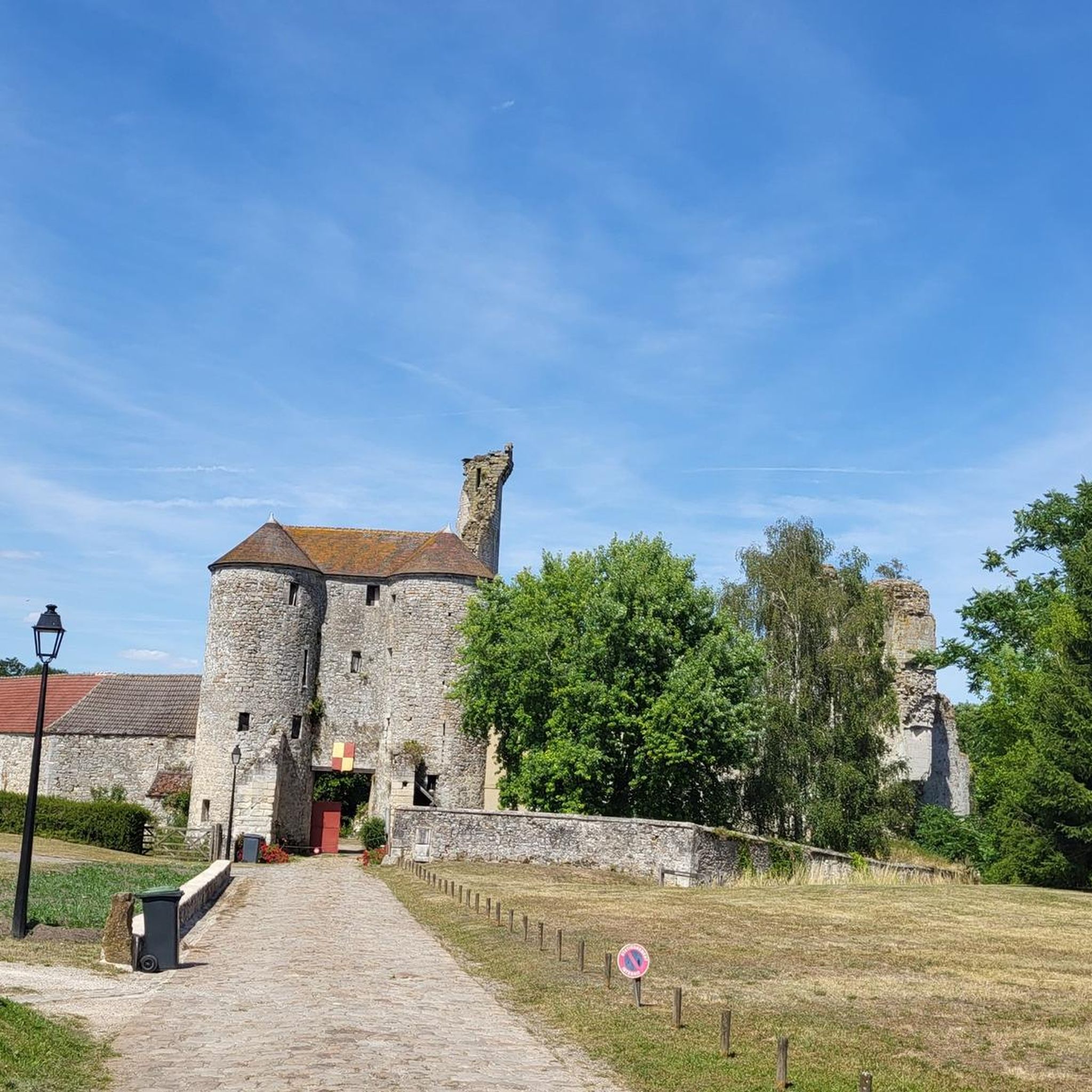
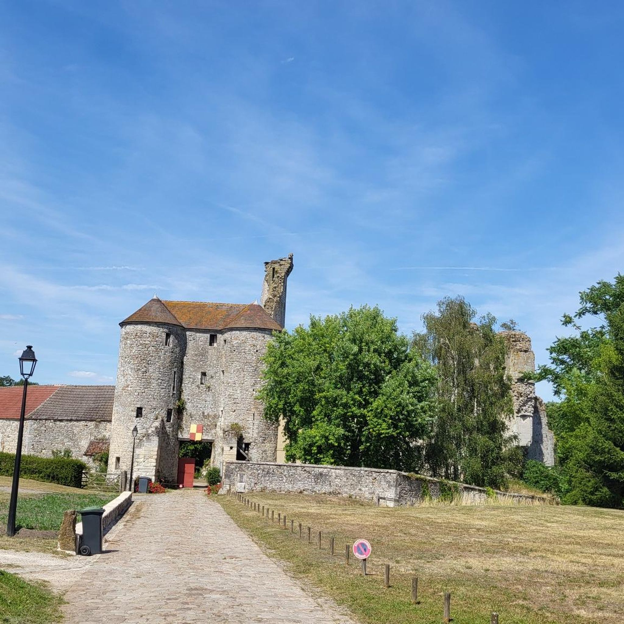
The Château de Montépilloy is a medieval castle in ruins which was built in the 12th century by Guy III le Bouteiller de Senlis, a nobleman in the service of the kings of France. It was the scene of several battles and sieges during the Hundred Years' War and the Wars of Religion. You will be able to discover the remains of the imposing keep, the polygonal enclosure, the entrance gate and the unfinished “new castle” which date from different periods in the history of the castle. The castle is surrounded by forests and offers panoramic views of the countryside. You can also enjoy the charm of the neighboring village of Montépilloy, which has a church, a fountain and an old washhouse. The castle is open to the public from June to September.
2
0
Mont Pagnotte is the highest point in Valois and one of the highest in the Paris region, with an altitude of 222 meters. It was also an ancient Celtic and Gallo-Roman colony, of which you can still see some ruins along the way. The trail passes through the magnificent Halatte forest, where you can appreciate the diversity of trees and wildlife. From the summit of Mont Pagnotte, you can admire a panoramic view of the forest and the surrounding countryside. It's the perfect place for a run to escape the city.
3
0
The remains of a Gallo-Roman temple dedicated to healing and built by a Gallic tribe, the Sulbanectes, in the middle of the 1st century AD. You can admire the ex-votos, coins, vases and fibulae discovered during excavations at the Senlis art and archeology museum. The temple is hidden in the bushes, so you have to follow a forest path to reach it. It is a unique and fascinating site that will take you back in time.
2
0
Mont Pagnotte is the highest point in Valois and one of the highest in the Paris region, with an altitude of 222 meters. It was also an ancient Celtic and Gallo-Roman colony, of which you can still see some ruins along the way. The trail takes you through the magnificent Halatte Forest, where you can appreciate the diversity of trees and wildlife. From the summit of Mont Pagnotte, you can admire a panoramic view of the forest and the surrounding countryside. This is an ideal hike for a family outing or to escape the city.
2
0
Frequently Asked Questions
How many hiking trails are available around Montépilloy, and what are their difficulty levels?
Montépilloy offers a wide range of hiking opportunities, with over 170 trails available. These include 97 easy routes, 79 moderate paths, and 3 more challenging trails, ensuring options for every fitness level.
What kind of landscapes can I expect to see while hiking near Montépilloy?
The region around Montépilloy is characterized by the picturesque Valois plain, offering open vistas and a serene environment. You'll also find yourself within the Oise-Pays de France Regional Natural Park, with forests like the nearby Ermenonville Forest contributing to the natural appeal. The sandy soil makes for comfortable hiking conditions year-round.
Are there any historical landmarks or points of interest to explore along the hiking trails?
Yes, Montépilloy is rich in history. The village is dominated by the impressive 12th-century Montépilloy Castle keep, visible from afar. You can also explore other historical sites such as Chaalis Abbey or the charming medieval city of Senlis, which can be reached via routes like the Senlis – Senlis, medieval city loop from Senlis.
What do other hikers enjoy most about hiking in Montépilloy?
The hiking trails around Montépilloy are highly rated by the komoot community, with an average score of 4.5 stars from over 200 reviews. Hikers often praise the diverse terrain, the blend of natural beauty with historical landmarks, and the well-maintained paths within the Oise-Pays de France Regional Natural Park.
Are there any circular hiking routes available in the Montépilloy area?
Yes, many routes in the region are circular, allowing you to start and end in the same location. An example is the challenging Boar engraved in stone – Mont Pagnotte viewpoint loop from Chamant, which offers expansive views.
What is the best time of year to go hiking in Montépilloy?
Thanks to the region's sandy soil, hiking in Montépilloy is comfortable even in winter. However, spring and autumn offer pleasant temperatures and beautiful scenery, making them ideal for exploring the Valois plain and its forests. Summer is also suitable, though it can be warmer.
Are there any viewpoints or scenic spots along the trails?
Absolutely. The strategic location of Montépilloy Castle on a hilltop provides expansive views of the surrounding plain. Additionally, the Mont Pagnotte viewpoint is a notable scenic spot, offering panoramic vistas of the natural park.
Are the hiking trails around Montépilloy suitable for families with children?
Many of the 97 easy routes in the Montépilloy area are well-suited for families. The generally gentle terrain of the Valois plain and the presence of historical sites like the castle can make for engaging walks for all ages. Always check the specific route details for distance and elevation to ensure it matches your family's capabilities.
Can I find parking facilities near the trailheads in Montépilloy?
While specific parking details vary by trailhead, Montépilloy and surrounding villages typically offer public parking options. It's advisable to check local signage or use detailed route information on platforms like komoot to find designated parking areas close to your chosen starting point.
What kind of wildlife might I encounter while hiking in the Oise-Pays de France Regional Natural Park?
As part of the Oise-Pays de France Regional Natural Park, the area around Montépilloy is home to diverse wildlife. Depending on the season and time of day, you might spot various bird species, deer, wild boar, and smaller mammals in the forests and open plains. Maintaining a respectful distance and quiet observation is encouraged.
Are there any longer, more challenging hikes for experienced hikers?
Yes, for experienced hikers seeking a greater challenge, there are 3 difficult routes available. These trails often cover longer distances and may include more significant elevation changes, such as the Boar engraved in stone – Mont Pagnotte viewpoint loop from Chamant, which spans over 21 km.
What is the historical significance of Montépilloy Castle?
Montépilloy Castle is a significant historical monument dating back to the 12th century, with well-preserved vestiges including moats, an enceinte, and a gatehouse. It's also historically notable for its connection to Joan of Arc, who fought her last battle near Montépilloy in 1429. You can learn more about its history and archaeological significance through guided tours during specific periods. For more information, you can visit Chantilly-Senlis Tourisme.
Most popular routes around Montépilloy
Most popular attractions around Montépilloy

Get inspired with the komoot mobile app


Explore more
Browse the best Hikes in other regions.
