The best running trails around Gibloux
4.4
(13)
702
runners
51
runs
Jogging routes around Gibloux traverse a diverse landscape in the canton of Fribourg, Switzerland. The region is characterized by its namesake Mont Gibloux, which offers panoramic views of the Alps and Jura mountains. Runners can explore dense fir forests, expansive meadows, and picturesque river valleys, including the Sarine River and Lac de la Gruyère. This varied terrain provides a range of running experiences across different elevations.
Best jogging routes around Gibloux
- The most popular jogging route is Magnedens Cycling Route…
Last updated: July 10, 2026
121
runners
13.5km
01:28
150m
150m
Moderate run. Good fitness required. Mostly paved surfaces. Suitable for all skill levels.
4.0
(7)
87
runners
4.86km
00:32
60m
60m
Easy run. Great for any fitness level. Mostly paved surfaces. Suitable for all skill levels.

Sign up for free
55
runners
31.2km
03:39
630m
630m
Hard run. Very good fitness required. Mostly paved surfaces. Suitable for all skill levels.
24
runners
8.66km
01:09
320m
320m
Hard run. Very good fitness required. Mostly paved surfaces. Suitable for all skill levels.
4.0
(1)
31
runners
9.96km
01:10
200m
200m
Moderate run. Good fitness required. Mostly paved surfaces. Suitable for all skill levels.
Get access to more routes and recommendations from other explorers.
Sign up for free
Already have an account?
Our route recommendations are based on thousands of hikes, rides, and runs completed by other people on komoot.
Start today with a free account
Your next adventure awaits.
Login or Signup
Tips from the Community

Here is a link to it: https://fribourg.ch/de/la-gruyere/architektur-und-denkmaeler/zu-fuss-auf-die-ogoz-insel-greyerzersee/
1
0

With the exception of 2 short steep ascents, it is also very good to ride with a gravel bike.
1
0

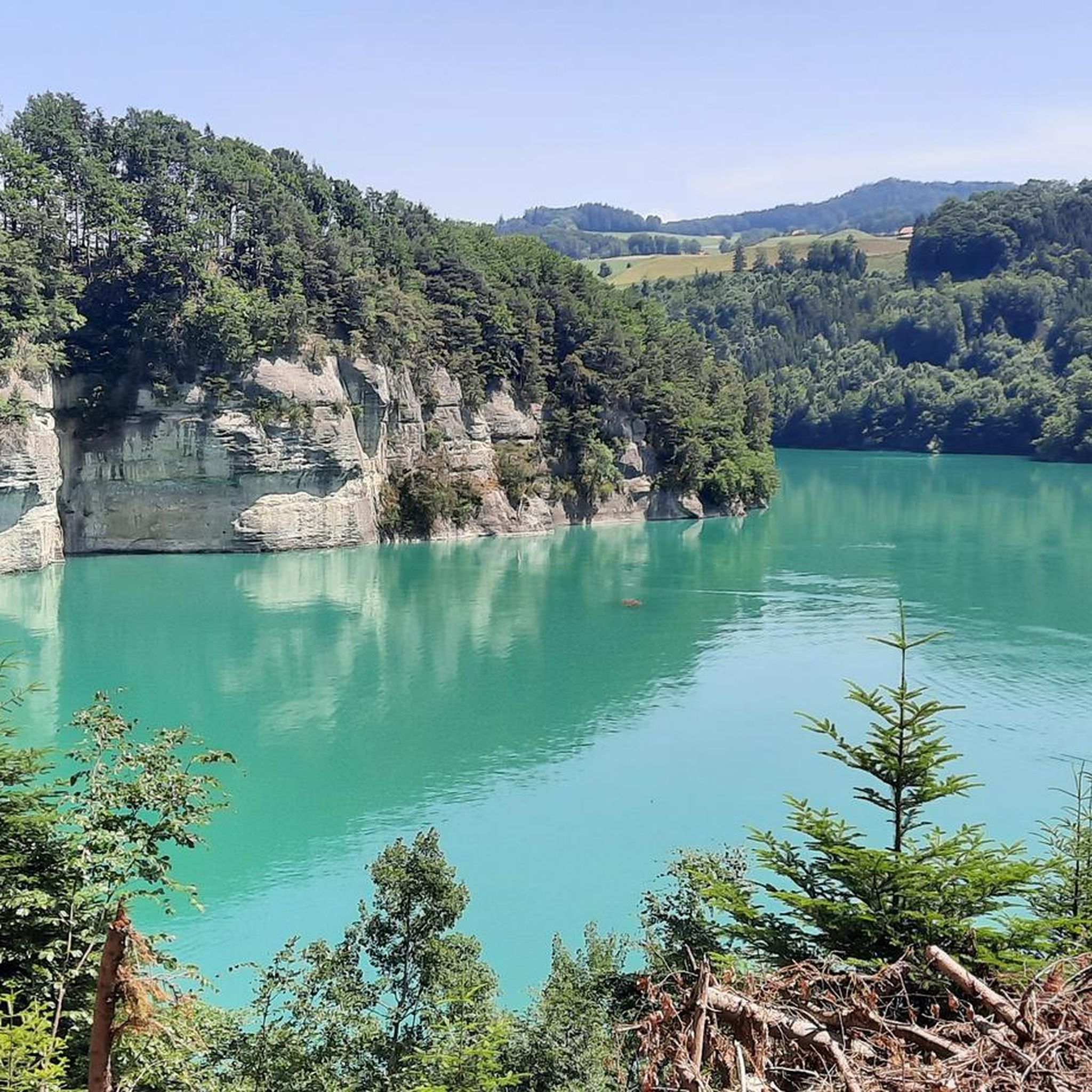
Access on foot on the île d'Ogoz below 668 m above sea level. Usually it’s in March. Also island accessible on boat: https://ogoz.ch/ile-ogoz/flotte-electro-solaire/
1
0


Imposing Rossens dam which forms Lake Gruyère. Height 83m. The water is transported to the Hauterive power station by a penstock in order to be processed.
2
0

wild, jagged bank, with a view of the Intyamon
1
0

The Passage à l'île d'Ogoz is a natural causeway that connects the continent to the island of Ogoz in Lake Gruyère. The island is home to the ruins of two medieval castles and a restored chapel, which you can discover after crossing the lake on foot. The passage is only accessible when the water level is below 668 m. So check the conditions before leaving.
3
0
Along the west bank of the Guyère pond, you will have a breathtaking view of the bridge and the island of Ogoz.
2
0
Frequently Asked Questions
How many running routes are available in Gibloux?
Komoot offers over 50 diverse running routes around Gibloux. These trails cater to various fitness levels, winding through the region's beautiful landscapes.
What kind of terrain can I expect on running trails in Gibloux?
The Gibloux region offers a varied topography for runners. You'll find trails traversing dense fir forests, expansive meadows, and picturesque river valleys, including paths along the Sarine River and Lac de la Gruyère. The routes often feature moderate to significant elevation changes, especially around Mont Gibloux.
Are there running routes suitable for beginners in Gibloux?
Yes, Gibloux has several easy running options perfect for beginners. For instance, the Running loop from Farvagny is an easy 4.9 km path with gentle gradients, ideal for those new to trail running.
What are some challenging running routes for experienced runners in Gibloux?
Experienced runners looking for a challenge will find several difficult routes. The Tour du Gibloux – Gravel Path on Le Gibloux loop from Le Glèbe is a demanding 8.7 km route with significant elevation gain, leading towards the Gibloux Tower. Another option is the longer View of Lake Gruyère – Passage to Île d'Ogoz loop from Rossens (FR), which is 31.2 km and features substantial climbs.
Are there running trails in Gibloux with scenic viewpoints?
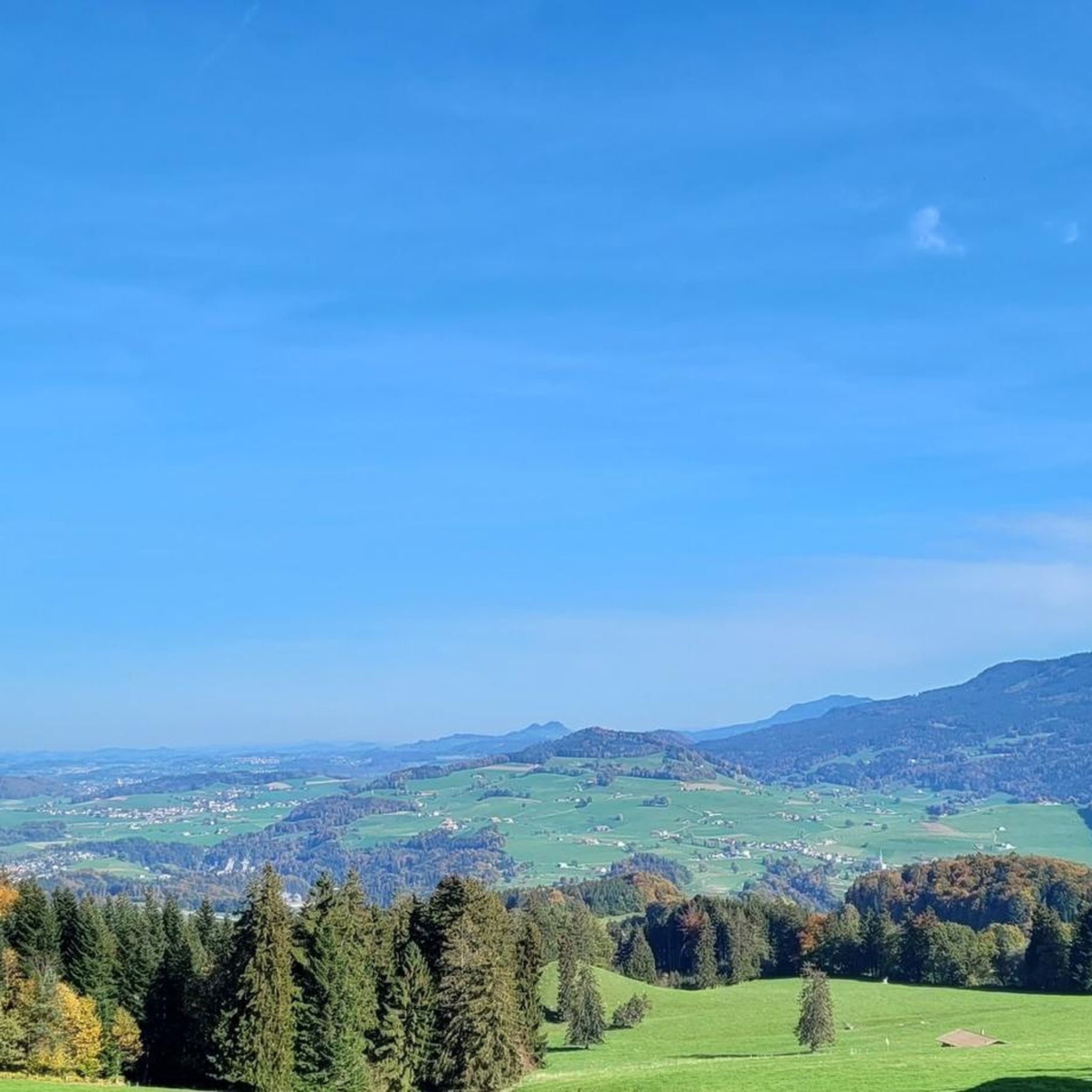
Absolutely! Many running routes in Gibloux offer breathtaking panoramic views. Mont Gibloux itself provides exceptional vistas of the Alps, Jura mountains, and the Swiss Plateau. The View of Lake Gruyère – Passage to Île d'Ogoz loop from Rossens (FR) specifically highlights views of Lake Gruyère. You can also reach the Gibloux Tower for an elevated viewing platform.
What notable landmarks or attractions can I see while running in Gibloux?
Runners in Gibloux can encounter several interesting landmarks. You might pass by the impressive Grandfey Viaduct, a historic railway bridge, or explore parts of the picturesque Gottéron Valley. The La Berra summit also offers extensive views of Lac de La Gruyère and the pre-Alps.
Are there any circular running routes in Gibloux?
Yes, many running routes in Gibloux are designed as loops, offering convenient circular paths. Examples include the Magnedens Cycling Route – The Surroundings of Farvagny loop from Gibloux and the Running loop from Farvagny, both of which are circular.
What do other runners enjoy most about jogging in Gibloux?
The running routes in Gibloux are highly rated by the komoot community, with an average score of 4.6 stars from over 10 reviews. Runners often praise the diverse landscapes, from dense forests to open meadows, and the well-marked trails that provide an immersive natural experience.
Are there family-friendly running options in Gibloux?
Yes, Gibloux offers options suitable for families. Many of the easier hiking trails can be enjoyed for a family run or walk, and the Gibloux Sculpture Trail provides an engaging and easy nature walk. Look for routes with gentle gradients and shorter distances, such as the Running loop from Farvagny.
Can I bring my dog on the running trails in Gibloux?
While specific regulations can vary, many natural trails in Gibloux are generally dog-friendly. It's always recommended to keep your dog on a leash, especially in agricultural areas or near wildlife, and to check local signage for any specific restrictions on individual paths.
Are there any huts or places to rest along the running routes in Gibloux?
Yes, the region has several huts and buvettes where you might find a place to rest or get refreshments. Notable spots include Duvette Crau Rapp, Les Allières Mountain Hut, and Buvette Alp Flühkäseberg, which can be found along various trails in the wider Gibloux area.
What is the best season for running in Gibloux?
Gibloux offers good running conditions throughout much of the year. Spring and autumn provide pleasant temperatures and beautiful scenery with changing foliage. Summer is also popular, though it's best to run in the mornings or evenings to avoid the midday heat. Winter running is possible, especially on lower elevation trails, but some higher paths may be affected by snow or ice.
Most popular attractions around Gibloux

Get inspired with the komoot mobile app


Explore more
Browse the best Running Trails & Routes in other regions.
