The best running trails around Kriens
4.5
(140)
7,349
runners
144
runs
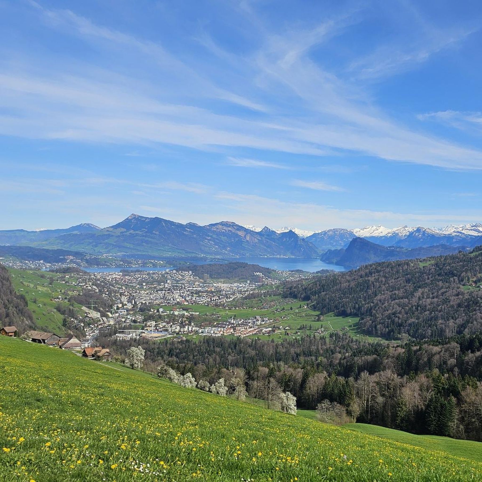
Jogging around Kriens offers a diverse landscape for runners, situated at the foot of Mount Pilatus in the Lucerne region of Switzerland. The area features a blend of accessible urban-fringe green spaces, challenging alpine terrain, and expansive forests. Runners can explore varied surfaces, from well-maintained paths around Sonnenberg to rugged trails within the Krienser Hochwald and the scenic Eigenthal valley. This rich natural environment provides numerous running routes with varying inclines and panoramic views.
Best jogging routes around Kriens
- The most popular jogging route is Swiss Trailrun Pilatus - Up Lucerne's local mountain, a 5.7 miles (9.2 km) trail that takes 1 hour 44 minutes to complete. This difficult route offers significant elevation gain and panoramic views of Lucerne and the surrounding Alps.
- Another top favourite among local runners is View of Lake Lucerne – Lake Lucerne loop from Kriens, a moderate 8.3 miles (13.4 km) path. This route provides scenic views of Lake Lucerne and features varied terrain suitable for a longer run.
- Local runners also love the Running loop from Luzern Allmend/Messe, a 5.2 miles (8.4 km) trail leading through accessible urban-fringe green spaces, often completed in about 1 hour 3 minutes.
- Jogging around Kriens is defined by mountainous terrain like Mount Pilatus, the serene Eigenthal valley, and the expansive Krienser Hochwald. The network of running routes offers options for various ability levels, from easy loops to challenging trail runs.
- The routes in Kriens are highly rated by the komoot community with an average score of 4.6 stars from over 70 reviews. More than 6000 runners have used komoot to explore Kriens's varied terrain.
Last updated: October 6, 2026
4.8
(20)
292
runners
9.18km
01:45
890m
10m
Hard run. Very good fitness required. Mostly paved surfaces. Suitable for all skill levels.
4.7
(26)
3,214
runners
Hard run. Very good fitness required. Mostly paved surfaces. Suitable for all skill levels.

4.7
(7)
303
runners
13.0km
01:25
170m
170m
Moderate run. Good fitness required. Mostly paved surfaces. Suitable for all skill levels.
4.5
(4)
444
runners
Moderate run. Good fitness required. Mostly paved surfaces. Suitable for all skill levels.
5.0
(3)
164
runners
13.1km
02:05
920m
920m
Hard run. Very good fitness required. Sure-footedness, sturdy shoes and alpine experience required.
Get access to more routes and recommendations from other explorers.
Already have an account?
Our route recommendations are based on thousands of hikes, rides, and runs completed by other people on komoot.
Start today with a free account
Your next adventure awaits.
Other adventures around Kriens

Tips from the Community

Lucerne is a city worth visiting in any weather and at any time of year. Lake Lucerne, the Reuss river and of course the Pilatus are Switzerland in one place.
0
0

Perfect bike tour, even better if you have an e-bike
0
0

A must for every visit to Lucerne.
0
0

Perfect cycling road next to the lake with frequent swimming spots!
0
0

Whether for a leisurely stroll, jogging, or cycling – the promenade is perfect for anyone who wants to be active yet relaxed. 🚶♂️🏃♀️🚴♂️
0
0
Especially at sunset, the city is bathed in a warm, golden light – a magical moment full of peace and beauty 🌅✨.
0
0
This view invites you to dream, pause, and recharge – a true gift from nature that offers peace and vastness 🌿💙.
0
0

The Nationalquai becomes the Luzernerquai here, but the proximity to the shore remains the same. While the promenade is still very busy near the old town, it becomes quieter and quieter the further away you get.
0
0
Frequently Asked Questions
What kind of terrain can I expect on running routes around Kriens?
Kriens offers a diverse landscape for runners. You'll find a mix of accessible urban-fringe green spaces, expansive forests like the Krienser Hochwald, and challenging alpine terrain, especially towards Mount Pilatus. Paths vary from well-maintained trails around Sonnenberg to more rugged routes in the Eigenthal valley, providing options for all levels and preferences.
Are there many easy running routes suitable for beginners in Kriens?
Yes, Kriens has options for beginners. While many routes offer significant elevation, there are 5 easy routes available. For a gentler experience, consider paths around Sonnenberg Mountain or accessible green spaces on the outskirts of Kriens. The region's network of trails caters to various ability levels.
Can I find long-distance running trails in the Kriens area?
Absolutely. Kriens provides numerous options for longer runs. For example, the View of Lake Lucerne – Lake Lucerne loop from Kriens is a moderate 13.4 km (8.3 miles) path, offering varied terrain and scenic views. Another option is the View of Lake Lucerne – View of Lake Lucerne loop from Kriens Mattenhof, which stretches for nearly 16 km (10 miles).
What natural features or landmarks can I see while jogging in Kriens?
Kriens is rich in natural beauty and landmarks. Many routes offer breathtaking panoramic views of Lucerne and the surrounding Alps, especially those leading towards Mount Pilatus. You can also explore picturesque paths along the Krienbach River, extensive forests like the Krienser Hochwald, and the scenic Eigenthal valley. For specific attractions, consider routes near waterfalls or historic sites like Meggenhorn Castle.
Are there any circular running routes available in Kriens?
Yes, many running routes in Kriens are designed as loops. For instance, the popular View of Lake Lucerne – Lake Lucerne loop from Kriens is a great example of a circular route. Another option is the Running loop from Luzern Allmend/Messe, which takes you through urban-fringe green spaces.
What do other runners say about the jogging trails in Kriens?
The running routes in Kriens are highly regarded by the komoot community, with an impressive average score of 4.6 stars from over 70 reviews. More than 6,000 runners have used komoot to explore the varied terrain, often praising the stunning views, diverse landscapes, and well-maintained paths.
Are there any family-friendly jogging routes in Kriens?
While many routes offer varied terrain, some areas are more suitable for families. The Sonnenberg Mountain features well-maintained paths that are ideal for lighter jogs. Additionally, the Krienseregg area, with its adventure playgrounds, offers a family-friendly outdoor spot that could be combined with shorter, easier runs.
Can I jog with my dog on the trails around Kriens?
Many natural areas around Kriens, including the extensive forests and paths in the Eigenthal valley, are generally dog-friendly. However, it's always advisable to check local regulations for specific trails, especially in nature preserves like Wolfsschlucht, and to keep your dog on a leash where required to protect wildlife and other trail users.
What are the options for parking or public transport to access running routes in Kriens?
Kriens is well-connected. Many routes are accessible from central Kriens, which has public transport links. For routes starting further afield, parking is generally available near trailheads, especially in areas like Sonnenberg or the outskirts of Kriens. Specific parking information can often be found on individual route descriptions.
Are there any challenging trail running options near Kriens?
Yes, for those seeking a challenge, the region around Mount Pilatus offers demanding trail running. The Swiss Trailrun Pilatus - Up Lucerne's local mountain is a difficult 9.2 km (5.7 miles) route known for its significant elevation gain and rewarding panoramic views of Lucerne and the surrounding Alps.
What is the best time of year for running in Kriens?
Kriens offers great running opportunities throughout much of the year. Spring and autumn provide pleasant temperatures and beautiful scenery. Summer is ideal for higher alpine routes, though lower paths can be enjoyed too. During winter, while Pilatus transforms for snow sports, some lower elevation paths may still be accessible for running, but conditions can vary, so checking local weather and trail status is recommended.
Are there any routes that offer views of Lake Lucerne?
Yes, several routes provide stunning views of Lake Lucerne. A popular choice is the View of Lake Lucerne – Lake Lucerne loop from Kriens, which offers scenic vistas of the lake. Another route, the View of Lake Lucerne – View of Lake Lucerne loop from Kriens Mattenhof, also features beautiful lake views.
Most popular attractions around Kriens

Get inspired with the komoot mobile app


Explore more
Browse the best Running Trails & Routes in other regions.
