The best mountain hikes around Hochdorf
4.8
(26)
231
hikers
14
hikes
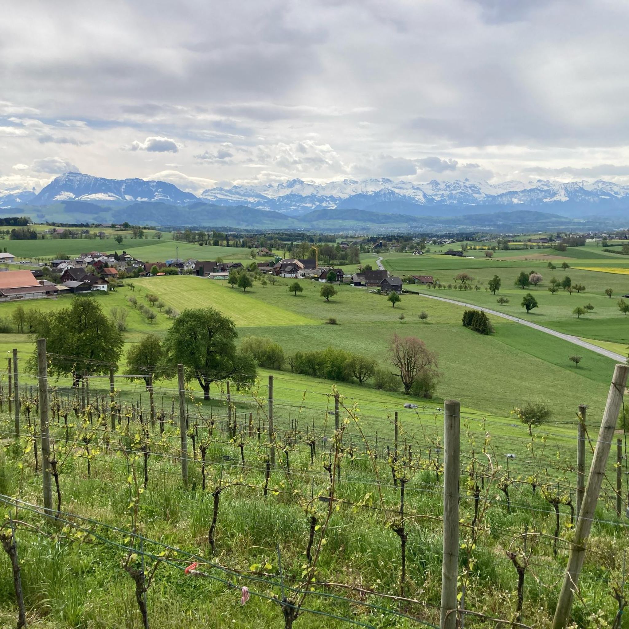
Mountaineering routes around Hochdorf, a municipality in the Canton of Lucerne, Switzerland, primarily involve challenging mountain hikes and scenic ascents rather than technical climbing. The region is characterized by diverse landscapes, including the Hallwilersee, Baldeggersee, and Sempachersee, which offer picturesque lakeside trails. While not featuring high-alpine peaks, the area provides numerous summits, such as the Lindenberg, that can be climbed for their panoramic views. The terrain includes dynamic natural elements like springs and forested areas extending to lake shores.
Best…
Last updated: May 25, 2026
5.0
(3)
23
hikers
15.4km
07:11
1,130m
1,130m
Hard mountaineering route. Very good fitness required. Sure-footedness, sturdy shoes and alpine experience required.
5.0
(4)
13
hikers
14.5km
06:18
970m
970m
Hard mountaineering route. Very good fitness required. Sure-footedness, sturdy shoes and alpine experience required.

Sign up for free
5.0
(1)
15
hikers
14.2km
05:13
910m
910m
Hard mountaineering route. Very good fitness required. Mostly accessible paths. Sure-footedness required.
13
hikers
18.2km
07:37
1,340m
1,340m
Hard mountaineering route. Very good fitness required. Mostly accessible paths. Sure-footedness required.
5.0
(1)
13
hikers
11.9km
04:23
630m
620m
Moderate mountaineering route. Good fitness required. Mostly accessible paths. Sure-footedness required.
3.0
(1)
8
hikers
9.19km
03:22
460m
460m
Moderate mountaineering route. Good fitness required. Mostly accessible paths. Sure-footedness required.
7
hikers
15.1km
07:09
1,300m
1,300m
Hard mountaineering route. Very good fitness required. Sure-footedness, sturdy shoes and alpine experience required.
4.7
(3)
6
hikers
14.1km
06:27
930m
930m
Hard mountaineering route. Very good fitness required. Sure-footedness, sturdy shoes and alpine experience required.
4
hikers
11.6km
04:17
590m
590m
Moderate mountaineering route. Good fitness required. Mostly accessible paths. Sure-footedness required.
5.0
(4)
5
hikers
Hard mountaineering route. Very good fitness required. Mostly accessible paths. Sure-footedness required.
Get access to more routes and recommendations from other explorers.
Sign up for free
Already have an account?
Our route recommendations are based on thousands of hikes, rides, and runs completed by other people on komoot.
Start today with a free account
Your next adventure awaits.
Login or Signup
Popular around Hochdorf
Mountain Hikes around Emmen
Mountain Hikes around Inwil

Hope 1000 – Bikepacking Switzerland in 11 stages
The Herzroute – Cycling through the heart of Switzerland
The most beautiful swimming lakes in Switzerland
The most popular swimming spots around Zurich
Mehr laufen in Luzern: Trainingsstrecken für jedes Level
Schottergenuss und Gaumenschmaus – Grand Gourmet Rides durch die Schweiz
Hiking around Hochdorf
Cycling around Hochdorf
Other adventures around Hochdorf


Tips from the Community

pretty here, very pretty
0
0
pretty here, very pretty
0
0

Accessible on foot from Märenschlag towards Mittaggüpfi. Caution: slightly exposed section without safety barriers.
0
0
Slightly exposed and unsecured section on the ascent from Märenschlag towards Mittaggüpfi.
0
0


A large stone from China, from the Chinese twin city there.
1
0

A challenging ascent and descent from Fräkmüntegg, with a fantastic panoramic view at the church. See my tour with description and photos from September 5, 2025: https://www.komoot.com/de-de/tour/2554068247?share_token=aeSLPUZ1urYKe1JXS1aLJsSgD4fh9M6XTWj0oGIO6eV7vAwqAs&ref=wtd
0
0

Beautiful alpine pasture. Very busy on weekends. Starting point for hikes toward Küssnacht, Immensee, and Rigi.
5
0
Frequently Asked Questions
What kind of terrain can I expect on mountaineering routes around Hochdorf?
The mountaineering routes around Hochdorf primarily involve challenging mountain hikes and scenic ascents. You'll encounter diverse landscapes, including forested slopes, dynamic natural elements like springs and 'Tobel' (ravines), and areas where forests extend directly to lake shores. While not featuring high-alpine peaks, the region offers numerous summits, such as the Lindenberg, that provide panoramic views.
Are there any easier mountaineering routes suitable for beginners in the Hochdorf area?
Yes, while many routes are challenging, there are options for varying ability levels. For a moderate experience, consider the Eigenthal-Talboden Trail Sign loop from Fuchsbühl, which covers 11.5 km with over 600 meters of elevation gain. Another moderate option is the Narcissus and Orchid Meadow – Alpe Ober Lauelen loop from Lindenbrücke, a 9.2 km route with around 460 meters of ascent.
What are some of the more challenging mountaineering routes near Hochdorf?
For those seeking a significant challenge, the region offers several difficult routes. The Klimsen Chapel – Pilatus Dragon Trail loop from Lindenbrücke is a demanding 15.2 km trail with over 1100 meters of elevation gain. Another difficult option is the Rigi Kulm loop from Küssnacht am Rigi, which spans 18.1 km and features over 1300 meters of ascent.
How long do mountaineering routes around Hochdorf typically take to complete?
The duration varies significantly depending on the route's length and difficulty. For instance, a challenging route like the Klimsen Chapel – Pilatus Dragon Trail loop from Lindenbrücke can take over 7 hours. Moderate routes, such as the Trockenmattsattel – Eigental Valley loop from Lindenbrücke, typically take around 4 hours and 40 minutes.
Are there any circular mountaineering routes in the Hochdorf area?
Yes, many of the routes around Hochdorf are designed as loops, allowing you to start and end at the same point. Examples include the difficult Klimsenhorn – Klimsen Chapel loop from Lindenbrücke and the moderate Eigenthal-Talboden Trail Sign – Buechsteg Wooden Bridge loop from Lindenbrücke.
What are some notable landmarks or viewpoints I can expect to see along the routes?
The region offers numerous scenic highlights. You can enjoy views of Lake Lucerne, as seen on the View of Lake Lucerne – Fräkmüntegg (1415 m) loop from Kriens. The area is also known for its beautiful lakes like Hallwilersee, Baldeggersee, and Sempachersee. For specific points of interest, consider visiting the Hoben Alpine Farm or the tranquil Gnome Cabin in the Forest.
What is the best time of year to go mountaineering around Hochdorf?
The region is generally best explored during the warmer months, from spring to autumn, when trails are clear of snow and weather conditions are more stable. Spring brings blooming narcissus and orchid meadows, while autumn offers vibrant foliage. Winter mountaineering is possible but requires specialized equipment and experience due to snow and ice conditions.
Are there family-friendly mountaineering options in Hochdorf?
While many routes are challenging, some areas offer more accessible options. The region's lakes, like Sempachersee and Hallwilersee, provide opportunities for leisurely walks. The Riffig Pond near Emmen, though not directly on a mountaineering route, is a secluded spot with a fire pit and playground, ideal for families looking for a relaxed outdoor experience.
What do other mountaineers enjoy most about the routes in Hochdorf?
The routes in Hochdorf are highly rated by the komoot community, with an average score of 4.8 stars from over 20 reviews. Reviewers often praise the rewarding views from the summits, the diverse landscapes encompassing lakes and forests, and the challenge presented by the ascents. Many appreciate the well-maintained trails and the sense of accomplishment after completing a demanding hike.
Are there any facilities or places to eat near the mountaineering routes?
Yes, you can find various amenities in the region. Along some routes, you might encounter alpine farms or shelters. For example, the Hoben Alpine Farm offers a place to stop. The broader area also features huts and forest inns, such as the Forest inn, providing opportunities for refreshments.
Is it possible to reach the mountaineering routes using public transport?
Hochdorf is a municipality in the Canton of Lucerne, Switzerland, which generally has a well-developed public transport network. While specific starting points for each route may vary, it is often possible to reach trailheads via local buses or trains connecting to the main towns and villages in the region. It's advisable to check local transport schedules for the specific starting point of your chosen route.
Are there specific parking areas available for mountaineers?
For many popular trailheads around Hochdorf, designated parking areas are usually available, especially near villages or major access points. However, parking availability can vary, particularly during peak seasons. It's recommended to research parking options for your specific starting point in advance, especially for longer or more popular routes.
Most popular routes around Hochdorf
Most popular attractions around Hochdorf

Get inspired with the komoot mobile app


Didn’t find what you were looking for?
Check out more Mountain Hikes & Routes throughout Hochdorf below and find the perfect route in your destination.
Explore more
Browse the best Mountain Hikes & Routes in other regions.
