The best road cycling routes around Druyes-Les-Belles-Fontaines
4.0
(19)
379
riders
76
rides
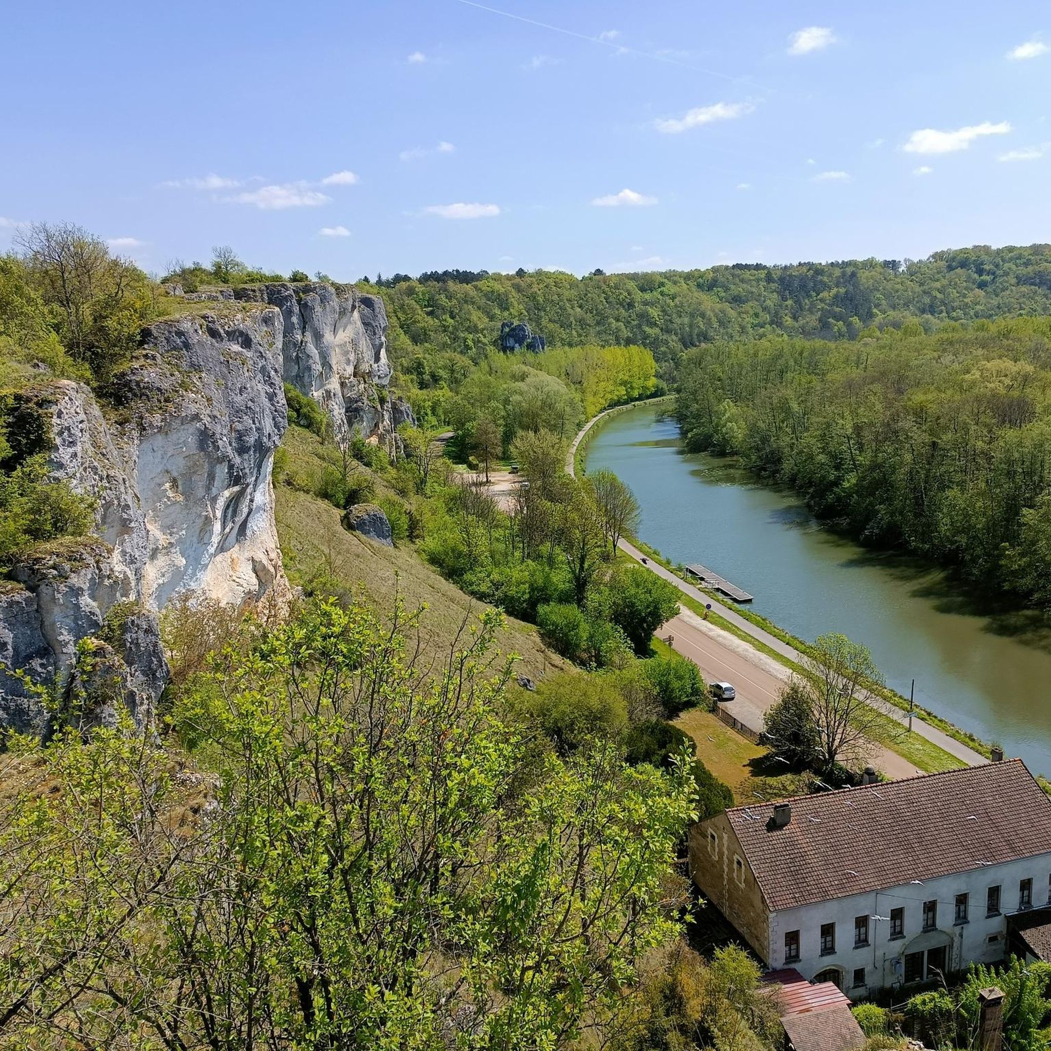
Road cycling routes around Druyes-Les-Belles-Fontaines traverse a landscape characterized by rolling hills, forests, and open fields within the Yonne department. The area features varied terrain with both gentle and steeper slopes, suitable for road cycling. Limestone formations and natural springs contribute to the region's distinct geographical features. The village itself is situated at the foot of cliffs, offering diverse elevation changes for cyclists.
Best road cycling routes around Druyes-Les-Belles-Fontaines
- The most popular road cycling route is Château de Druyes –…
Last updated: November 1, 2026
7
riders
49.7km
02:18
530m
530m
Moderate road ride. Good fitness required. Some segments of this route may be unpaved and difficult to ride.
4
riders
36.7km
01:38
380m
380m
Moderate road ride. Good fitness required. Mostly well-paved surfaces and easy to ride.

4.0
(1)
7
riders
Moderate road ride. Good fitness required. Mostly well-paved surfaces and easy to ride.
5
riders
43.7km
01:51
320m
320m
Moderate road ride. Good fitness required. Mostly well-paved surfaces and easy to ride.
7
riders
33.3km
01:30
300m
300m
Moderate road ride. Good fitness required. Some segments of this route may be unpaved and difficult to ride.
Get access to more routes and recommendations from other explorers.
Already have an account?
Our route recommendations are based on thousands of hikes, rides, and runs completed by other people on komoot.
Start today with a free account
Your next adventure awaits.


Tips from the Community

The marshes of the Druyes valley, covering an area of 63 hectares, have been renatured. They have since hosted great biodiversity. In particular, you will be able to observe unique Burgundy-Franche-Comté species such as the spotted locustella or the water rail. At the end of the well-developed path, you will find an ornithological observatory. Access is open and free all year round.
2
0
Straddling the Nièvre and the Yonne, a very pretty little asphalt road. Quiet and surrounded by woods, it connects the hamlets of Villeprenoy and Charmois, via the Vaux d'Oisy.
2
0

In this turn a beautiful view of the fortress of Druyes emerging from the forest.
0
0
City of character which deserves to be among the most beautiful villages in France with a little more development. To have : 1 - the castle and the small surrounding village after a beautiful climb from the village. 2 - the pond hidden behind the houses in the center. A quiet corner with a beautiful overview of the village. There you will understand where the name Belles Fontaines comes from.
0
0
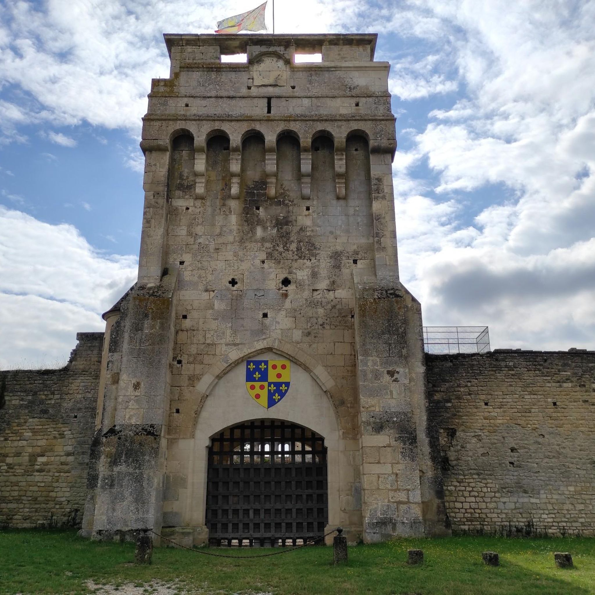
It was only at the end of the 12th century that the current castle of Druyes appears in the texts. Previously, during the 11th century, a first wooden castle would have been built on the site of the said castle. Druyes is part of the first generation of castles from the time of King Philippe Auguste. It is built on a square plan of 52.3 meters per side. It is an imposing building which is one of the most important specimens of military architecture from the Romanesque period in Burgundy. Private property, the castle is open to visitors. It is reached by crossing the postern which is the gateway to the fortified village, where absolute calm seems to reign. The castle dominates the town of character of Druyes Les Belles Fontaines, which deserves to be listed among the most beautiful villages in France, if it were a little better highlighted. Note a beautiful climb to climb from the village to the castle
1
0

Fortified Gate - classified as a historic monument. This gate is part of the enclosure of the lower courtyard of the castle which crowned the rock overlooking the valley and dominating the only possible crossing of the river. A second gate existed on the current rue de la Rampe. The enclosure dates from the 12th century. It was protected, to the east, by four still visible towers, one of which has just been restored. On the west coast, the enclosure appears as a very large wall, 2 m thick and 4 m high. It is incorporated into gardens and houses, but still visible. It was lined with a dry ditch. The postern did not include a drawbridge. It was closed by a heavy double door, the stone pivot cups of which can still be seen in the lower part. The machicolations made it possible to throw stones at the attackers. They probably date from the 14th century. This door has been classified as a historic monument since May 9, 1888.
7
0
Beautiful 12th century castle visible from afar. Entrance costs 5 euros (as of 2021). Out of season the castle is only open on weekends. There is even a circular hiking trail where the castle is almost always visible. www.chateau-de-druyes.com
7
0
Bridge built at the time of the fortified castle and the church (12th century). It replaced a wooden bridge established over a ford by Saint Romain in the 6th century. In the Middle Ages, bridge and castle went hand in hand because any river crossing gave rise to a toll. In 1859, the bridge, which was 5.50 m wide, was widened by 2.50 m to adapt it to the transformation of the main roads into secondary roads. During 2004, it was completely renovated.
6
0
Frequently Asked Questions
What kind of terrain can I expect when road cycling around Druyes-Les-Belles-Fontaines?
The region around Druyes-Les-Belles-Fontaines is characterized by rolling hills, dense woodlands, and open fields. You'll encounter varied terrain with both gentle and steeper slopes, offering a mix of challenges for road cyclists. The village itself is nestled at the foot of cliffs, contributing to diverse elevation changes.
How many road cycling routes are available in the Druyes-Les-Belles-Fontaines area?
There are over 70 road cycling routes available around Druyes-Les-Belles-Fontaines, catering to various skill levels. This includes a good selection of moderate routes, with some easier and more challenging options as well.
Are there any easy road cycling routes suitable for beginners in Druyes-Les-Belles-Fontaines?
Yes, there are routes suitable for beginners. Out of the many options, 16 routes are classified as easy, offering a gentler introduction to road cycling in the area. These routes typically feature less elevation gain and shorter distances.
What are some notable landmarks or natural features I might see while cycling?
Road cycling routes often pass by historical landmarks and natural features. You can explore the impressive 12th-century Château de Druyes, the medieval Fortified Gate of Druyes-les-Belles-Fontaines, or the picturesque Bridge Over the Druyes. The region is also known for its 'beautiful springs' and the Druyes Marsh, offering scenic natural beauty.
What do other road cyclists enjoy most about the routes in Druyes-Les-Belles-Fontaines?
The routes in Druyes-Les-Belles-Fontaines are highly rated by the komoot community, with an average score of 4.1 stars from over 10 reviews. Cyclists often praise the varied countryside, the mix of gentle and steeper slopes, and the opportunity to pass by historical landmarks.
Are there any family-friendly road cycling options in the area?
While specific family-friendly road cycling routes are not explicitly detailed, the presence of easy routes and a path fitted for bicycles along the nearby Loire river suggests that there are options suitable for families. The rolling landscapes with gentle slopes can be enjoyable for various ages.
Where can I find parking for road cycling in Druyes-Les-Belles-Fontaines?
Parking is generally available within the village of Druyes-Les-Belles-Fontaines. For specific starting points of routes, it's advisable to check the individual route details on komoot, as many tours start from villages like Fougilet or Sougères-en-Puisaye, which typically offer local parking.
Is it possible to rent bicycles in Druyes-Les-Belles-Fontaines or nearby?
Yes, bicycle rentals are available in the broader region, particularly along the path that follows the nearby Loire river. While not explicitly stated for Druyes-Les-Belles-Fontaines village itself, this indicates a cycling-friendly infrastructure in the wider area.
What is the best time of year to go road cycling in Druyes-Les-Belles-Fontaines?
The region's climate, typical of Burgundy, makes spring and autumn ideal for road cycling. These seasons offer pleasant temperatures and beautiful scenery, with fewer crowds than peak summer. Summer can also be enjoyable, but be prepared for warmer weather.
Are there any circular road cycling routes available?
Yes, many of the routes are designed as loops, allowing you to start and end in the same location. Examples include the Château de Druyes – Bridge Over the Druyes loop from Fougilet and the Druyes-les-Belles-Fontaines loop from Sougères-en-Puisaye.
Can I find places to eat or stay in Druyes-Les-Belles-Fontaines?
Druyes-Les-Belles-Fontaines, being a charming commune, offers local amenities. You can expect to find cafes, pubs, and accommodation options within the village or in nearby towns, providing convenient stops during or after your cycling adventures.
What is the longest moderate road cycling route in the area?
One of the longer moderate routes is the Roadbike loop from Sougères-en-Puisaye, which covers approximately 52.6 kilometers (32.7 miles) and involves about 440 meters of elevation gain.
Most popular routes around Druyes-Les-Belles-Fontaines
Most popular attractions around Druyes-Les-Belles-Fontaines

Get inspired with the komoot mobile app


Explore more
Browse the best Road cycling routes in other regions.
