The best road cycling routes around Droupt-Sainte-Marie
4.3
(6)
182
riders
11
rides
Road cycling routes around Droupt-Sainte-Marie primarily traverse the flat plains of the Aube department, characterized by agricultural landscapes and river valleys. The region features routes alongside the Upper Seine Canal, offering consistent, low-gradient cycling. Some areas include gentle hills, such as those found near vineyards, providing slight elevation changes. The terrain is generally accessible for various road cycling abilities.
Best road cycling routes around Droupt-Sainte-Marie
- The most popular road cycling route is Upper Seine Canal – Towpath loop from Méry-sur-Seine…
Last updated: May 21, 2026
5.0
(2)
84
riders
46.5km
01:47
40m
40m
Moderate road ride. Great for any fitness level. Some segments of this route may be unpaved and difficult to ride.
5.0
(2)
20
riders
53.8km
02:07
220m
220m
Moderate road ride. Good fitness required. Mostly well-paved surfaces and easy to ride.

Sign up for free
4.0
(1)
16
riders
47.7km
01:49
120m
120m
Easy road ride. Great for any fitness level. Mostly well-paved surfaces and easy to ride.
10
riders
41.6km
01:38
50m
50m
Easy road ride. Great for any fitness level. Mostly well-paved surfaces and easy to ride.
10
riders
21.7km
00:49
20m
20m
Easy road ride. Great for any fitness level. Mostly well-paved surfaces and easy to ride.
Get access to more routes and recommendations from other explorers.
Sign up for free
Already have an account?
Our route recommendations are based on thousands of hikes, rides, and runs completed by other people on komoot.
Start today with a free account
Your next adventure awaits.
Login or Signup
Popular around Droupt-Sainte-Marie

Tips from the Community

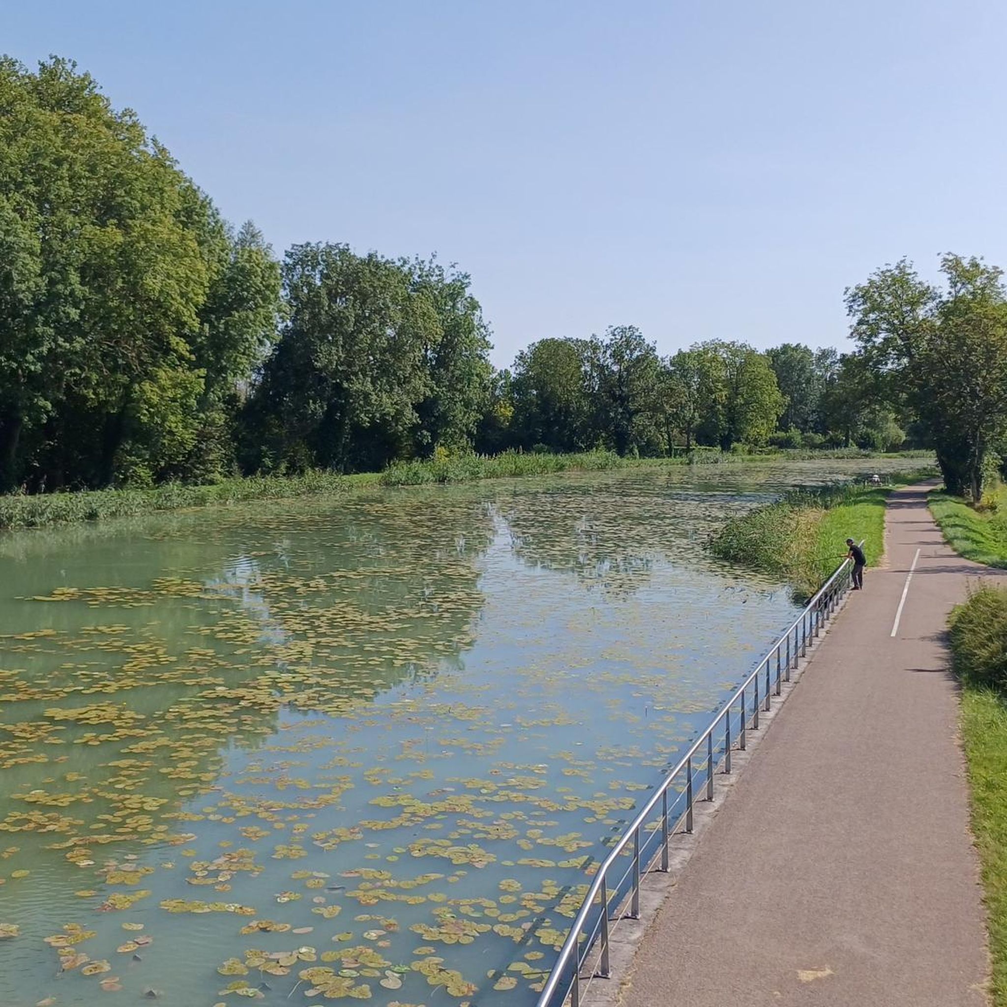
A "chemin de halage", in German "treidelpfad", which runs alongside the waterway right next to the bed of the river or canal, was an indispensable part of the transport infrastructure in earlier times. Before ships could move using motor power, horses ran along the bank and pulled the ship against the current. This was called "treideln", and this is how the "treidelpfads" got their name, which has been passed down to this day. Where these paths directly on the bank have been preserved, they are often used by hikers and cyclists.
0
0

do not hesitate to return to the main road then onto the canal at each crossing
0
0

Vélo-route Canal de la Haute Seine. A delight. I recommend
0
0

This path, which was used to tow barges from the shore, offers a variety of landscapes, from forests to fields. The path is largely flat and easy to follow, and you can enjoy views of the river and surrounding countryside.
3
0

Nice bar-restaurant along the Voie Verte de La Seine for a drink, lunch or aperitif.
0
0

The Haute-Seine canal connects the Seine to the Saône in Bourgogne-Franche-Comté. It offers beautiful landscapes and testifies to the river engineering of the 19th century. The greenway that runs along it is perfect for cycling!
0
0

Green Lane on the South Shore
0
0

Tarmac but pleasant path Possibility of taking parallel paths in the forest
0
0
Frequently Asked Questions
What is the general terrain like for road cycling around Droupt-Sainte-Marie?
The region primarily features the flat plains of the Aube department, characterized by agricultural landscapes and river valleys. You'll find routes alongside the Upper Seine Canal, offering consistent, low-gradient cycling. Some areas, particularly near vineyards, introduce gentle hills, providing slight elevation changes.
How many road cycling routes are available in the Droupt-Sainte-Marie area?
There are over 10 road cycling routes documented on komoot for the Droupt-Sainte-Marie area, catering to various skill levels.
Are there easy road cycling routes suitable for beginners in Droupt-Sainte-Marie?
Yes, about half of the routes in the area are rated as easy. An example is the Upper Seine Canal loop from Savières, which is a 29.6-mile (47.7 km) trail with minimal elevation gain, ideal for a relaxed ride.
What kind of routes are available for more experienced road cyclists?
For those seeking more challenge, routes like the Haut de la côte de Montgueux – Montgueux Vineyard and Hill loop from Pouan-les-Vallées offer significant elevation changes over 52.1 miles (83.9 km), traversing vineyard hills for a more demanding experience.
Are there any circular road cycling routes in Droupt-Sainte-Marie?
Many of the routes in the Droupt-Sainte-Marie area are designed as loops, allowing you to start and finish at the same point. Examples include the Upper Seine Canal – Towpath loop from Méry-sur-Seine and the Roadbike loop from Saint-Mesmin.
What are the typical distances and durations for road cycling routes here?
Routes vary in length, from around 29 miles (47 km) to over 64 miles (103 km). Depending on the route and your pace, you can expect rides to last from under 2 hours to over 4 hours.
What do other road cyclists say about the routes in Droupt-Sainte-Marie?
The road cycling routes in Droupt-Sainte-Marie are highly rated by the komoot community, with an average score of 4.4 stars from over 7 reviews. Cyclists often appreciate the quiet canal-side paths and the scenic agricultural landscapes.
What is the best time of year for road cycling in Droupt-Sainte-Marie?
Spring and autumn generally offer the most pleasant conditions for road cycling, with milder temperatures and beautiful scenery. Summer can be enjoyable, but be prepared for warmer weather, especially on exposed agricultural roads. Winter cycling is possible, but check local weather conditions for ice or snow, particularly on less-trafficked routes.
Are there routes that follow canals or rivers?
Yes, a significant feature of road cycling in this area is the presence of routes along the Upper Seine Canal. These offer flat, consistent terrain and often provide a peaceful riding experience, such as the Upper Seine Canal – Towpath loop from Méry-sur-Seine.
Can I find longer road cycling routes for endurance training?
Absolutely. For longer rides, consider routes like the Velovoie de Lacs – Moulin de Dosches loop from Pouan-les-Vallées, which spans over 64 miles (103 km) and includes varied terrain suitable for longer endurance efforts.
What kind of scenery can I expect on these road cycling routes?
You can expect to cycle through expansive agricultural fields, alongside tranquil river valleys, and occasionally through charming villages. Routes near Montgueux also offer views of vineyards and gentle rolling hills.

Get inspired with the komoot mobile app


Explore more
Browse the best Road cycling routes in other regions.
