The best mountain hikes around Schwanden bei Brienz
4.7
(22)
146
hikers
16
hikes
Mountaineering around Schwanden bei Brienz offers diverse routes set against the dramatic backdrop of the Swiss Alps in the Bernese Oberland. The region is characterized by high alpine peaks, deep valleys, and the turquoise-blue Lake Brienz. Terrain includes challenging ridge trails like sections of the Hardergrat, forested slopes, and open alpine meadows, providing varied conditions for mountaineers.
Best mountaineering routes around Schwanden bei Brienz
- The most popular mountaineering route is Schrattenfluh – Hengst Summit loop from Salwideli, a 9.3…
Last updated: July 6, 2026
4.7
(3)
25
hikers
15.1km
05:33
790m
790m
Hard mountaineering route. Very good fitness required. Mostly accessible paths. Sure-footedness required.
5.0
(4)
23
hikers
11.7km
04:32
700m
700m
Hard mountaineering route. Good fitness required. Sure-footedness, sturdy shoes and alpine experience required.

Sign up for free
5.0
(1)
11
hikers
19.6km
07:53
1,180m
1,180m
Hard mountaineering route. Very good fitness required. Sure-footedness, sturdy shoes and alpine experience required.
4.3
(3)
12
hikers
10.9km
04:49
730m
730m
Hard mountaineering route. Good fitness required. Sure-footedness, sturdy shoes and alpine experience required.
5.0
(2)
6
hikers
9.34km
04:13
660m
660m
Moderate mountaineering route. Good fitness required. Mostly accessible paths. Sure-footedness required.
Get access to more routes and recommendations from other explorers.
Sign up for free
Already have an account?
Our route recommendations are based on thousands of hikes, rides, and runs completed by other people on komoot.
Start today with a free account
Your next adventure awaits.
Login or Signup
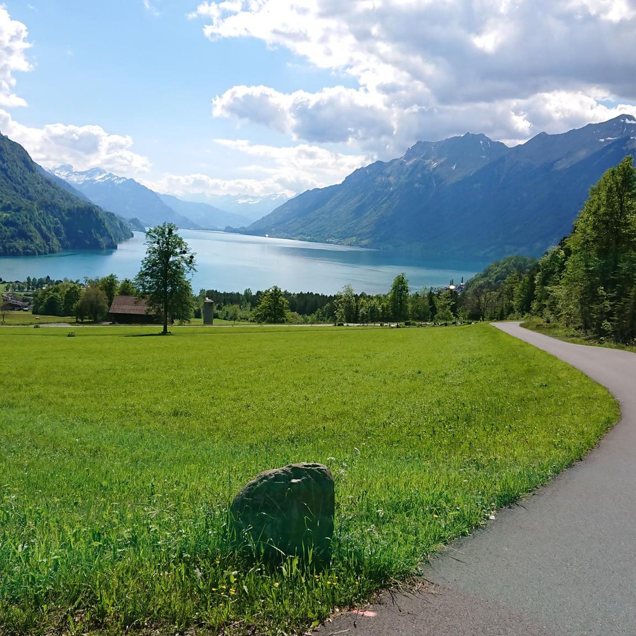
Tips from the Community

wonderful and very nice round
3
0
wonderful and very nice round
3
0
Frequently Asked Questions
How many mountaineering routes are available around Schwanden bei Brienz?
There are over 15 mountaineering routes around Schwanden bei Brienz, offering a variety of experiences for different skill levels. The komoot community has explored these diverse trails over 140 times.
What are the typical difficulty levels for mountaineering routes in this region?
The mountaineering routes around Schwanden bei Brienz primarily cater to experienced hikers, with 13 routes rated as difficult and 3 as moderate. There are currently no easy mountaineering routes listed, indicating the challenging nature of the alpine terrain.
What kind of terrain can I expect on mountaineering routes near Schwanden bei Brienz?
You can expect a diverse range of alpine terrain. Many routes feature challenging ridge trails, such as sections of the famous Hardergrat, which demand surefootedness and a good head for heights. You'll also traverse forested slopes and open alpine meadows, all set against the dramatic backdrop of the Swiss Alps and views of Lake Brienz.
When is the best time of year for mountaineering in Schwanden bei Brienz?
The best time for mountaineering in Schwanden bei Brienz is generally during the warmer months, from late spring to early autumn (June to September), when trails are clear of snow and weather conditions are more stable. Always check local weather forecasts and trail conditions before heading out, especially for higher alpine routes.
Are there any less challenging mountaineering routes for beginners or those seeking a moderate experience?
While many routes are challenging, there are a few moderate options available. For instance, the Schrattenfluh – Hengst Summit loop from Wagliseichnubel is a moderate 5.8-mile (9.3 km) trail that takes about 4 hours 13 minutes, offering varied alpine landscapes without the extreme difficulty of some other routes.
What are some notable landmarks or viewpoints I might encounter on these routes?
Mountaineering routes in this region offer spectacular views and access to iconic landmarks. You might reach the Brienzer Rothorn Summit, known for its panoramic views, or traverse trails near the Augstmatthorn Summit, where you might spot ibex. The region is also famous for its views over the turquoise-blue Lake Brienz.
Are there any circular mountaineering routes available?
Yes, several routes are designed as loops, allowing you to start and end at the same point. A popular example is the Schrattenfluh – Hengst Summit loop from Salwideli, a challenging 9.3-mile (15.0 km) trail, or the Alp Breitenfeld – Turren Restaurant loop from Turren, which is 7.3 miles (11.7 km) and leads to a mountain restaurant.
What do other mountaineers enjoy most about the routes in Schwanden bei Brienz?
The routes in Schwanden bei Brienz are highly rated by the komoot community, with an average score of 4.6 stars from over 20 reviews. Mountaineers often praise the breathtaking panoramic views, the challenging yet rewarding ascents, and the diverse alpine landscapes that make each tour unique.
Are there any specific safety considerations for mountaineering in this area?
Yes, especially on challenging ridge trails like sections of the Hardergrat. These trails are largely rated T3-T4 difficulty, with some T5 sections, requiring freedom from vertigo and stable footing. It's also advised to avoid these trails after rain, as they can become very slippery. Always carry appropriate gear, check weather conditions, and inform someone of your plans.
Can I access mountaineering routes using public transport?
Schwanden bei Brienz is located in the Bernese Oberland, a region with good public transport infrastructure. Many trailheads are accessible via train or bus, making it possible to reach routes without a car. For specific routes, it's best to check the starting point and plan your journey using local public transport schedules.
Are there opportunities to see wildlife on the mountaineering trails?
Yes, the steep slopes of the Augstmatthorn Summit, for example, are home to a large colony of ibex, providing excellent opportunities for wildlife spotting. Keep an eye out for other alpine fauna as you explore the diverse natural habitats.
Are there any routes that pass by waterfalls?
While the primary focus of these routes is mountaineering, the region around Brienz is known for its natural beauty, including waterfalls. The Grätli loop from Giessbachfälle is a challenging route that starts near the famous Giessbach Waterfalls, offering a chance to experience both alpine trails and stunning cascades.
What is the typical elevation gain on these mountaineering routes?
The elevation gain varies significantly depending on the route's length and difficulty. For instance, the challenging Brienzer Rothorn Summit – Brienzer Rothorn loop from Hagleren involves over 1100 meters of ascent, while a route like the Schrattenfluh – Hengst Summit loop from Wagliseichnubel has an elevation gain of around 660 meters.
Most popular routes around Schwanden bei Brienz
Most popular attractions around Schwanden bei Brienz

Get inspired with the komoot mobile app


Explore more
Browse the best Mountain Hikes & Routes in other regions.
