The best walks and hikes around Agnez-Lès-Duisans
4.4
(408)
3,606
hikers
251
hikes
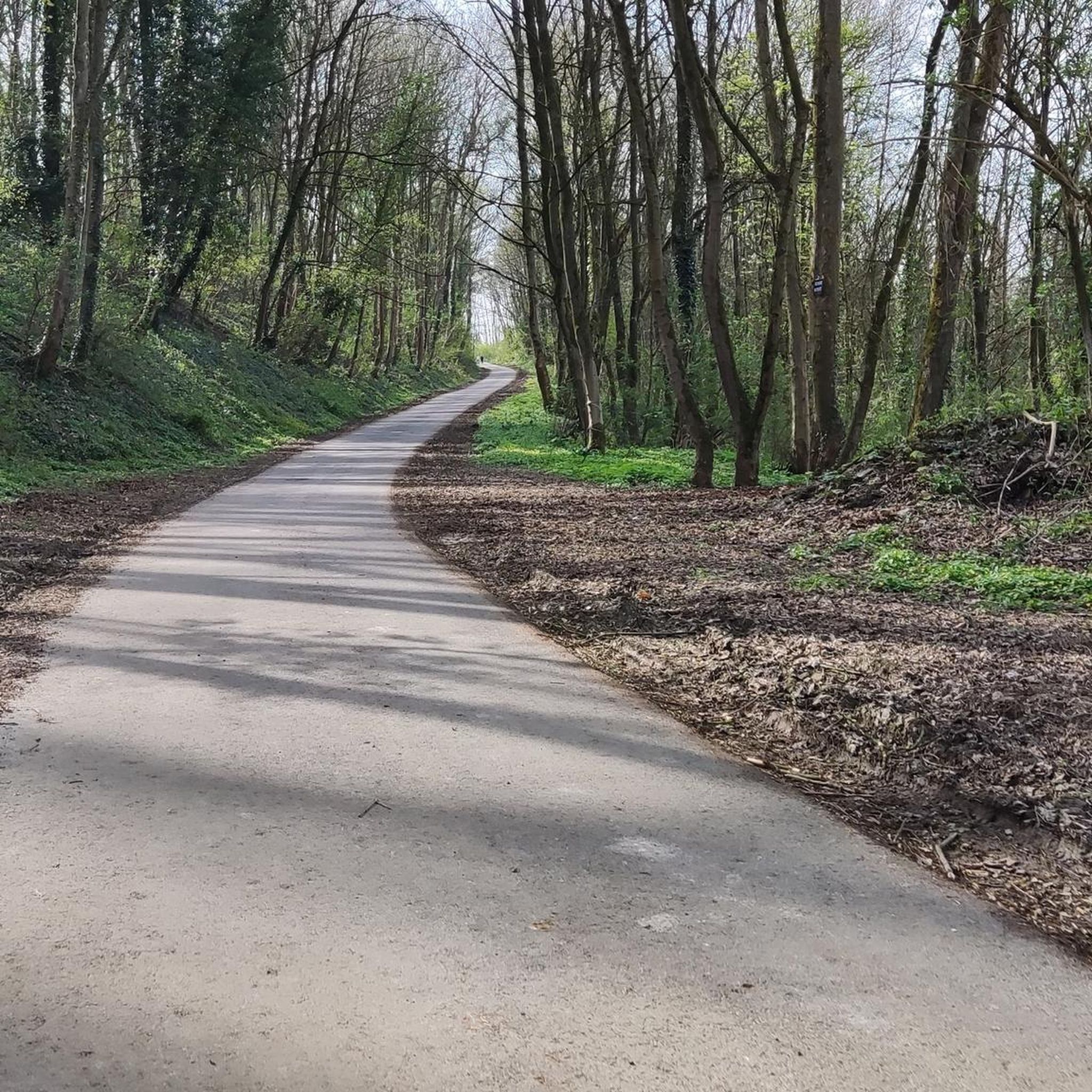
Hiking around Agnez-Lès-Duisans reveals a landscape characterized by gentle terrain and rural pathways. The area features a network of trails, including routes through marshlands and along local waterways. With minimal elevation changes, the region offers accessible hiking experiences.
Best hiking trails around Agnez-Lès-Duisans
- The most popular hiking route is Le Gy – Marœuil Marsh loop from Duisans, a 9.5 miles (15.4 km) trail that takes 4 hours 2 minutes to complete. This moderate route explores local marshlands and rural…
Last updated: June 25, 2026
4.0
(3)
17
hikers
Moderate hike. Good fitness required. Easily-accessible paths. Suitable for all skill levels.
5.0
(1)
8
hikers
7.83km
02:03
60m
60m
Moderate hike. Good fitness required. Easily-accessible paths. Suitable for all skill levels.

Sign up for free
4.5
(2)
6
hikers
8.04km
02:05
50m
50m
Moderate hike. Good fitness required. Easily-accessible paths. Suitable for all skill levels.
2.0
(1)
7
hikers
9.35km
02:26
60m
60m
Moderate hike. Good fitness required. Easily-accessible paths. Suitable for all skill levels.
4
hikers
15.5km
04:03
120m
120m
Moderate hike. Good fitness required. Easily-accessible paths. Suitable for all skill levels.
Get access to more routes and recommendations from other explorers.
Sign up for free
Already have an account?
Our route recommendations are based on thousands of hikes, rides, and runs completed by other people on komoot.
Start today with a free account
Your next adventure awaits.
Login or Signup



Tips from the Community

Mont César rises to a height of 138 meters on the left bank of the Thérain River, near the hamlet of Froidmont, in the municipality of Bailleul-sur-Thérain, in the Oise department. The hill, which overlooks the valley and surrounding marshes, has been inhabited since the Bronze Age and was likely a Gallo-Roman oppidum on an ancient, fortified Gallic camp. Archaeological excavations carried out since the 18th century have unearthed numerous objects and remains of fortifications. During excavations conducted in 1878 by Isidore Berton, Gallic coins and various objects from the Roman period were discovered. Want to know more? Click through to the source: https://fr.wikipedia.org/wiki/Mont_C%C3%A9sar
0
0
Etrun was home to a Benedictine abbey of noblewomen, founded in the 11th century, well-protected in the heart of this ancient Roman fortress! Want to know more? Click through to https://www.arraspaysdartois.com/nl/bezoek-het-pays-d-artois/etrun-village-patrimoine-erfgoeddorp-aan-de-bronn-van-het-pays-dartois/
1
0


The Maroeuil Marsh natural area offers a pleasant walk along the Scarpe River, with interesting flora and fauna. The signposting is illustrated by the small Vertigo de Des Moulins snail, which you can try to spot on the marsh plants.
0
0

This mill was made famous by the film “We found the 7th company” in 1975 when the soldiers Tassin, Pithiviers and Chaudard found themselves stuck there. This bucolic place offers a unique setting.
1
0

The Marais de Maroeuil is a swamp area of approximately 20 hectares in the municipality of Maroeuil. It is a protected natural area managed by the Conservatoire d'espaces naturels des Hauts-de-France. The swamp is home to a rich and varied flora and fauna, including the fumeterre, a rare species of orchid.
10
0
Beautiful place, but less and less visible due to privatization. Duisans had two water mills. This is located on the Scarpe in the hamlet of Louez and is a grain mill.
9
0
Frequently Asked Questions
How many hiking trails are available around Agnez-Lès-Duisans?
There are over 250 hiking routes in the Agnez-Lès-Duisans area, offering a wide variety of options for different preferences and skill levels.
What kind of terrain can I expect on hikes in Agnez-Lès-Duisans?
The landscape around Agnez-Lès-Duisans is characterized by gentle terrain, rural pathways, and routes through marshlands and along local waterways. You'll find minimal elevation changes, making for generally accessible hiking experiences.
Are there easy hiking trails suitable for beginners or casual walkers?
Yes, the region is well-suited for easy walks. Out of the over 250 routes, more than 100 are classified as easy, featuring gentle terrain and well-maintained paths perfect for a relaxed outing.
Are there any circular walks in Agnez-Lès-Duisans?
Many routes in the area are designed as loops, allowing you to start and finish at the same point. For example, consider the Le Gy loop from Duisans, which offers a pleasant 4.9-mile (8 km) circular path through the local landscape.
What are the typical lengths and durations of hikes in this area?
Hikes vary in length, but many popular routes range from moderate distances. For instance, the Hiking loop from Gouves is about 5.8 miles (9.4 km) and takes around 2 hours 25 minutes, while the Le Moulin de la Mère Crouzy – Maroeuil Marsh loop from Agnez-lès-Duisans covers 7.6 miles (12.3 km) and typically takes around 3 hours 12 minutes.
What do other hikers say about the trails in Agnez-Lès-Duisans?
The hiking trails in Agnez-Lès-Duisans are highly regarded by the komoot community, with an average rating of 4.4 stars from over 375 reviews. Hikers often praise the peaceful rural scenery and the well-maintained paths through marshlands and along waterways.
Are there any family-friendly hiking options?
Given the gentle terrain and numerous easy routes, many trails around Agnez-Lès-Duisans are suitable for families. These paths often avoid steep climbs and offer pleasant walks through the countryside, making them ideal for children.
Can I bring my dog on the hiking trails?
While specific regulations can vary, most rural paths and trails in the Agnez-Lès-Duisans area are generally dog-friendly. It's always advisable to keep your dog on a leash, especially near livestock or in protected natural areas like the Maroeuil Marsh, and to clean up after them.
What interesting landmarks or attractions can I see near the hiking trails?
The region offers several points of interest. You might encounter historical sites like the Notre-Dame-de-Lorette National Cemetery or the ruined church of Ablain-Saint-Nazaire. Natural highlights include the Marais de Maroeuil and the Scarpe riverbanks.
What is the best time of year to go hiking in Agnez-Lès-Duisans?
Spring and autumn are generally ideal for hiking in Agnez-Lès-Duisans, offering pleasant temperatures and beautiful natural colors. Summer can also be enjoyable, especially in the mornings or evenings, while winter hikes are possible but may require appropriate gear for colder, potentially wetter conditions.
Are there any trails that offer scenic views?
Many routes provide picturesque views of the surrounding countryside and marshlands. For example, the Le Gy – Marœuil Marsh loop from Duisans offers expansive views of the local marshlands and rural scenery, characteristic of the region's gentle landscape.
Most popular routes around Agnez-Lès-Duisans
Most popular attractions around Agnez-Lès-Duisans

Get inspired with the komoot mobile app


Explore more
Browse the best Hikes in other regions.
