The best walks and hikes around Fontanès-De-Sault
4.6
(303)
2,791
hikers
23
hikes
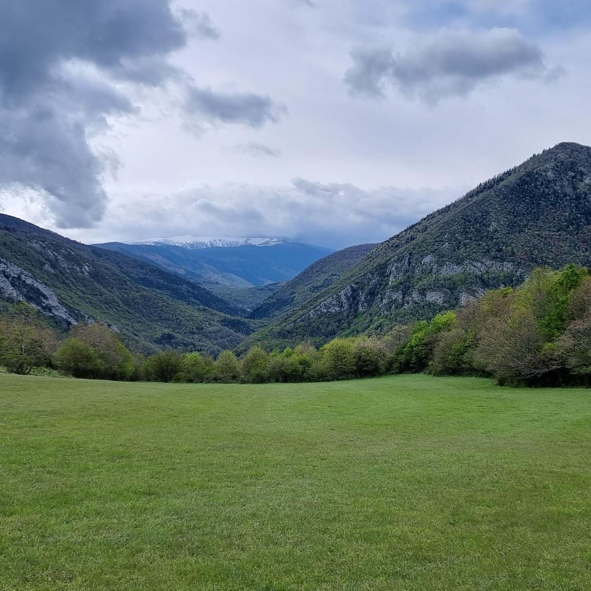
Hiking around Fontanès-De-Sault offers diverse landscapes within the heavily wooded Pays de Sault plateau, situated in the Aude department of France. The region is characterized by its mountain scenery, high-altitude lakes, and extensive forests, with elevations ranging from 990 to 1,310 meters. The Aude River drains the commune, contributing to its varied terrain and ecological significance, including two Natura 2000 sites.
Best hiking trails around Fontanès-De-Sault
- The most popular hiking route is Le Pic de Tarbesou - loop starting from…
Last updated: September 1, 2026
4.8
(111)
1,016
hikers
11.7km
04:45
600m
600m
Moderate hike. Good fitness required. Mostly accessible paths. Sure-footedness required.
5.0
(8)
93
hikers
10.3km
05:07
800m
800m
Hike the difficult 6.4-mile Le Roc Blanc trail from Laurenti forest refuge, gaining 2632 feet to panoramic views and Étang de Laurenti.

Sign up for free
4.7
(59)
363
hikers
10.3km
04:28
690m
690m
Moderate hike. Good fitness required. Mostly accessible paths. Sure-footedness required.
4.3
(6)
53
hikers
14.5km
06:10
880m
880m
Hard hike. Very good fitness required. Mostly accessible paths. Sure-footedness required.
4.7
(13)
116
hikers
Moderate hike. Good fitness required. Mostly accessible paths. Sure-footedness required.
Get access to more routes and recommendations from other explorers.
Sign up for free
Already have an account?
Our route recommendations are based on thousands of hikes, rides, and runs completed by other people on komoot.
Start today with a free account
Your next adventure awaits.
Login or Signup

Tips from the Community

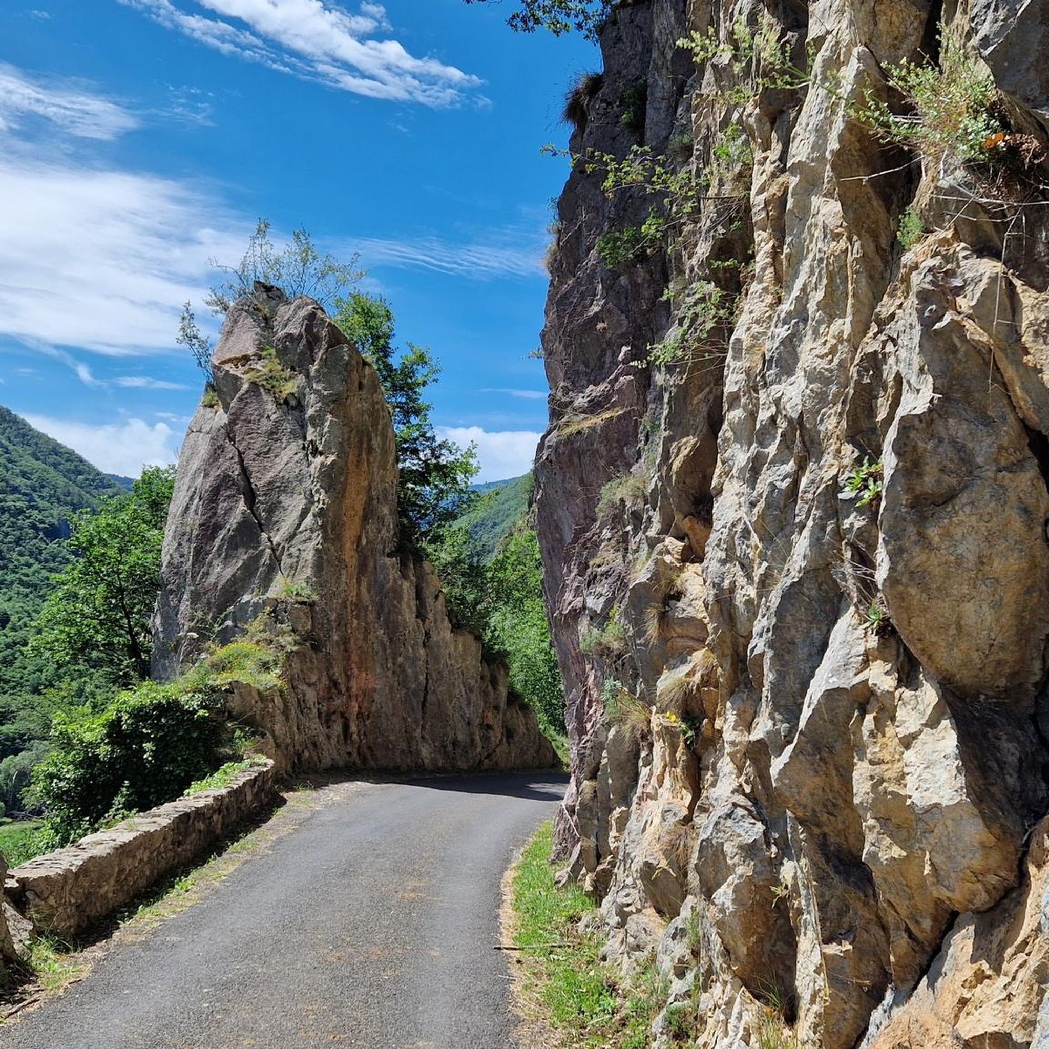
Small and narrow passage below the Pic de la Camisette, which is reached from the Col de Laurenti and gives way to the parallel valley.
0
0
This section runs along the middle of the slope between the two saddles and is somewhat tricky due to the narrowness and exposure of the path. Exercise caution and proceed carefully.
0
0
Beautiful free refuge located in a lovely setting.
0
0
Pass above Lake Laurenti with spectacular views. The great effort required to climb it is worth it.
0
0

Magnificent landscape at the summit of the peak. Pretty flower and some horses Nice hike don't forget to drink... water
1
0
Beautiful but very busy in the summer The road to the parking lot is a forest path
0
0

Like the reflection of the sun on water, your eyes will sparkle with a thousand lights. A magnificent place, let's protect and share it
0
0

The setting here is truly stunning. The Rabassoles ponds shine in the valley, standing out against the surrounding granite cliffs. You can see the Rabassoles pond (1,851 metres), the Blue pond (1,920 metres) and the Black pond (1,970 metres).
2
0
Frequently Asked Questions
What types of landscapes will I encounter while hiking around Fontanès-De-Sault?
The region around Fontanès-De-Sault is characterized by its diverse mountain scenery, heavily wooded plateaus, and high-altitude lakes. You'll find extensive forests, particularly within the Pays de Sault plateau, and trails often lead to picturesque lakes like Étang Noir, Étang Bleu, and Étang de Laurenti. Iconic ascents such as the Pic de Tarbésou offer magnificent panoramic views.
Are there any easy hiking trails suitable for beginners or families?
Yes, while the area offers challenging mountain treks, there are also easier options. The region has 2 easy routes and 15 moderate routes. For a moderate option that explores a beautiful lake, consider the Laurenti Lake – Laurenti Pond loop from Étang de Laurenti, which is 6.1 km long.
What are some notable natural features or landmarks to look out for on the trails?
Hikers can enjoy several natural and historical points of interest. The area is known for its high-altitude lakes and mountain peaks offering expansive views, such as the Pic de Tarbésou and Roc Blanc. You might also encounter geological curiosities, including caves and chasms, and sections of the historic “Chemin Vauban.” For specific viewpoints, consider highlights like View of the Hairpin Bends on the Col de Jau.
Can I find circular hiking routes in Fontanès-De-Sault?
Yes, the area offers numerous well-documented circular routes. A popular choice is the Le Pic de Tarbesou - loop starting from the Col de Pailhères car park, which is 11.7 km long and offers panoramic views. Another option is the Pic de Tarbesou – Coumeille de l'Ours Pass loop from Port de Pailhères, a 5.3 km moderate hike.
What is the best time of year to go hiking in this region?
The Pays de Sault plateau, where Fontanès-De-Sault is located, is particularly vibrant with autumnal colors, making autumn an excellent time for hiking. The extensive forests provide shaded routes, which can be pleasant during warmer months. However, the high-altitude nature means conditions can vary, so checking local weather is always recommended.
Are there any challenging hikes for experienced trekkers?
Absolutely. The region features 7 difficult routes for experienced hikers. A notable challenging trail is Le roc blanc – hike starting from the Laurenti forest refuge, a difficult 10.3 km path known for its significant elevation gain and expansive vistas.
What do other hikers say about the trails around Fontanès-De-Sault?
The routes in Fontanès-De-Sault are highly rated by the komoot community, with an average score of 4.7 stars from over 280 reviews. Hikers often praise the diverse terrain, from quiet woodlands to challenging mountain ascents, and the stunning panoramic views from peaks like Pic de Tarbésou.
Are there historical sites or cultural points of interest along the hiking trails?
Yes, the region has a rich historical backdrop. You can explore sections of the “Chemin Vauban,” a historic military supply route from the time of Louis XIV, which offers both natural beauty and cultural insights with explanatory panels. There's also the poignant trail “Sur les traces du Maquis de Picaussel,” which winds through forests to the former site of the French Resistance during WWII.
Where can I find parking for trailheads near Fontanès-De-Sault?
Many popular routes, such as the Le Pic de Tarbesou - loop starting from the Col de Pailhères car park, indicate starting points with available parking. The Col de Pailhères is a common access point for several trails in the area.
Are there any amenities like cafes or accommodation in Fontanès-De-Sault or nearby villages?
Fontanès-De-Sault is a secluded commune, but the broader Pays de Sault plateau and surrounding villages offer some amenities. While specific cafes or accommodation in Fontanès-De-Sault itself are limited, nearby areas would provide options for refreshments and lodging. It's advisable to check in advance for services in smaller villages.
Can I hike with my dog on the trails around Fontanès-De-Sault?
The region is known for its preserved nature, including Natura 2000 sites and ZNIEFFs. While many trails in France are dog-friendly, it's always best to check specific regulations for national nature reserves or protected areas you plan to enter. Generally, dogs should be kept on a leash to protect wildlife and ensure safety.
What is the overall elevation range for hiking in this area?
The Pays de Sault plateau, where Fontanès-De-Sault is situated, ranges from 990 to 1,310 meters in altitude. This means hikes can involve significant elevation changes, with some routes featuring over 800 meters of ascent, offering varied challenges and rewarding views.
Most popular attractions around Fontanès-De-Sault

Get inspired with the komoot mobile app


Explore more
Browse the best Hikes in other regions.
