The best road cycling routes around Lachamp-Raphaël
4.7
(38)
1,030
riders
37
rides
Road cycling routes around Lachamp-Raphaël are defined by the region's elevated position within the Ardèche department, featuring volcanic peaks and green mountainous terrain. Situated at 1330 meters, the area offers winding roads and plateaus, providing varied ascents and descents. Cyclists encounter diverse landscapes, including views of the Monts d'Ardèche and distant Alps. The terrain is characterized by its volcanic origins, with formations like the Mont Gerbier de Jonc and Suc de Montivernoux shaping the routes.
Best road cycling routes around…
Last updated: July 1, 2026
83
riders
58.8km
03:15
1,240m
1,240m
Hard road ride. Very good fitness required. Mostly well-paved surfaces and easy to ride.
5.0
(2)
71
riders
73.0km
04:05
1,630m
1,630m
Hard road ride. Very good fitness required. Some segments of this route may be unpaved and difficult to ride.

Sign up for free
55
riders
67.9km
03:33
1,230m
1,230m
Hard road ride. Very good fitness required. Mostly well-paved surfaces and easy to ride.
5.0
(1)
24
riders
54.9km
02:50
900m
900m
Moderate road ride. Good fitness required. Some segments of this route may be unpaved and difficult to ride.
4.5
(2)
21
riders
55.8km
03:15
1,370m
1,370m
Hard road ride. Very good fitness required. Mostly well-paved surfaces and easy to ride.
Get access to more routes and recommendations from other explorers.
Sign up for free
Already have an account?
Our route recommendations are based on thousands of hikes, rides, and runs completed by other people on komoot.
Start today with a free account
Your next adventure awaits.
Login or Signup
Tips from the Community

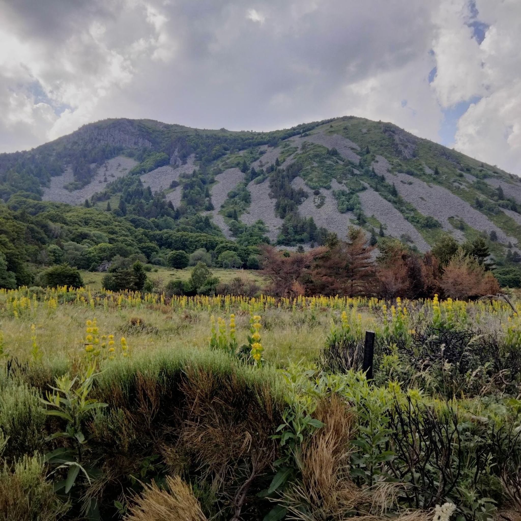
Col du Montivernoux 1320m. Suc de Montivernoux The legend tells that there were once three very pious shepherds from the same family. One lived in Soutron, the other in Lachamp-Raphaël, and the last in Saint-Andéol-de-Fourchades. They communicated using fires lit during the night. One night, there was no fire in Soutron. The next day, the shepherd was found dead on the rock. To celebrate his exemplary life, the inhabitants of the region built a small chapel on the rock. https://lachamp-raphael.fr/histoire-et-patrimoine/suc-de-montivernoux/
0
0
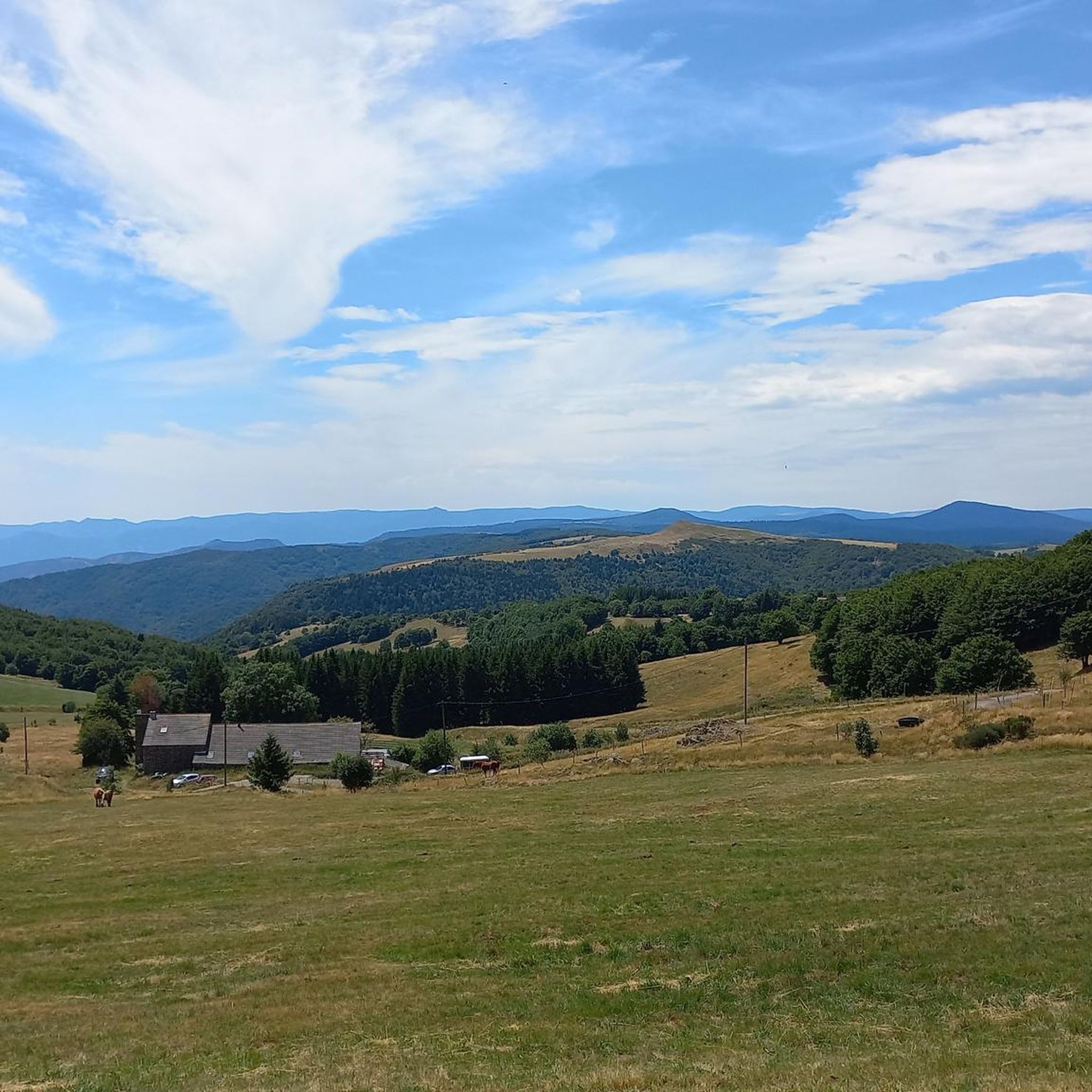
Located at an altitude of 1,330 meters, Lachamp-Raphaël is the highest village in the Ardèche. Dominated by the Montivernoux peak, the village offers exceptional panoramic views of the Alps and the Ardèche mountains. https://lachamp-raphael.fr/
0
0
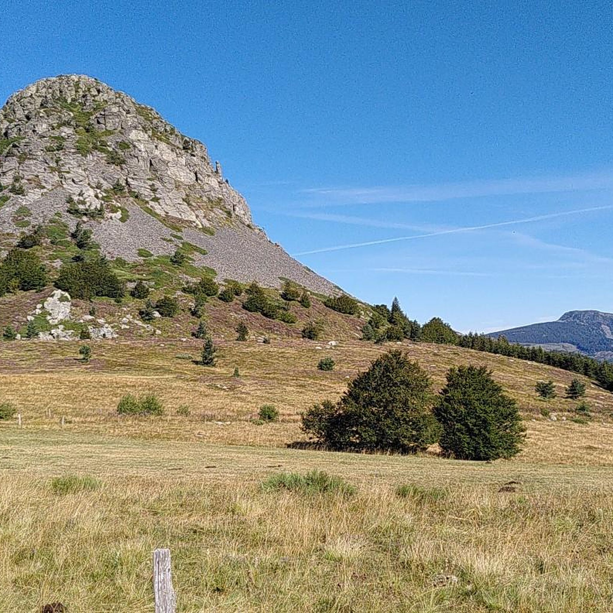
Eight million years old, Mont Gerbier-de-Jonc owes its conical shape to a viscous, cold lava that was unable to flow away. It is at its foot that the Loire River originates, in three places respectively designated as the geographical, authentic, and true sources. What if the Loire, in addition to its long journey to the Atlantic, also flowed into the Mediterranean? This is the intriguing hypothesis formulated by Gilles Clément after climbing the mountain following a period of drought, during which he nevertheless perceived a regular seepage in the rock. He imagines that Mont Gerbier-de-Jonc functions, in part, as a "water tower": a water trap based on the condensation of water vapor from clouds in desert regions. The collected water would flow at the foot of Mont Gerbier, towards the Atlantic Ocean and the Mediterranean Sea. https://www.lepartagedeseaux.fr/le-parcours-artistique/les-oeuvres-in-situ/la-tour-a-eau/
0
0

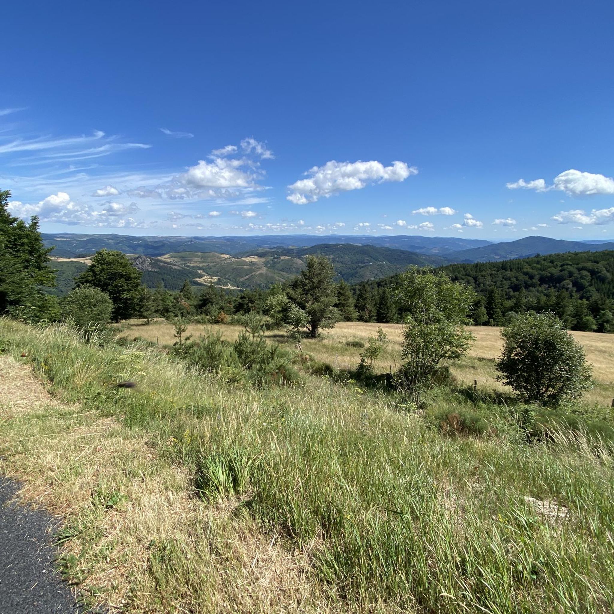
Small street, no traffic
0
0
Anyone who wants to stop for a bite to eat should stop here. There are few alternatives. A Grand Café Creme and a generous sandwich for 8 euros.
1
1
The Montivernoux peak is located in the Massif Central. It rises to an altitude of 1,441 meters in the Vivarais Mountains. It lies between the communes of Lachamp-Raphaël and Mézilhac. https://lachamp-raphael.fr/histoire-et-patrimoine/suc-de-montivernoux/
0
0
In the eastern foothills of the Massif Central, in a harsh climate, at an altitude of 1,380 meters, this former 17th-century farmhouse, built like a fortress in the heart of a windswept plateau, is now a must-see attraction located 3 kilometers from Mont Gerbier-de-Jonc. You'll admire its typical architecture, its 900 m² of phonolite slate roof (local volcanic slabs), its upside-down ship-shaped framework, and its impressive volumes (50 meters long and 10 meters wide). https://www.bourlatier.fr/FR/home.html
1
0
Frequently Asked Questions
What kind of terrain can I expect when road cycling around Lachamp-Raphaël?
The region around Lachamp-Raphaël, being the highest village in Ardèche at 1330 meters, is characterized by its volcanic origins. You'll encounter green, mountainous terrain, high-altitude plateaus, and winding roads. This includes diverse ascents and descents, with views of the Monts d'Ardèche and even the distant Alps. The area is known for its 292 distinct climbs, offering varied challenges.
Are there challenging road cycling routes in Lachamp-Raphaël?
Yes, Lachamp-Raphaël is an excellent destination for challenging road cycling. The area boasts numerous demanding mountain passes and climbs. For instance, the Col de Mézilhac (1,119 m) – Col du Gerbier de Jonc loop from Lachamp-Raphaël is a difficult 72.7 km path traversing high mountain passes. You can also test your endurance on climbs like the Col de la Croix de Boutières, reaching 1500 meters, or the Montivernoux Climb, a 15 km ascent to Lachamp-Raphaël with an average gradient of 5-6%.
What are some scenic viewpoints or attractions along the road cycling routes?
Road cycling routes around Lachamp-Raphaël offer breathtaking scenery and access to notable attractions. You can enjoy panoramic views of the Alps and the Monts d'Ardèche. Iconic landmarks include the Mont Gerbier de Jonc, the source of the Loire River, and the Cascade du Ray-Pic, a stunning waterfall with basalt column formations. The Montivernoux Climb itself provides splendid views of the Tanargue massif.
When is the best time of year to go road cycling in Lachamp-Raphaël?
Given Lachamp-Raphaël's elevated position, the best time for road cycling is typically from late spring through early autumn. This period offers more favorable weather conditions for tackling the region's mountainous terrain and high passes. The area is also known for snowshoeing in winter, indicating that colder months might be less suitable for road cycling.
Are there any easy or moderate road cycling routes suitable for less experienced riders?
While many routes in Lachamp-Raphaël are challenging, there are options for various ability levels. The region's network offers moderate climbs alongside demanding mountain passes. Out of 40 total routes, 21 are rated as moderate, and 1 is easy, providing choices for less experienced riders to enjoy the beautiful Ardèche landscape without extreme difficulty.
What do other cyclists say about road cycling in Lachamp-Raphaël?
The road cycling routes in Lachamp-Raphaël are highly rated by the komoot community, with an average score of 4.6 stars from over 40 reviews. More than 1,000 road cyclists have used komoot to explore the varied terrain, often praising the challenging climbs, expansive views, and the unique volcanic landscape of the Ardèche.
Can I find loop trails for road cycling in Lachamp-Raphaël?
Yes, many of the road cycling routes around Lachamp-Raphaël are designed as loops, allowing you to start and finish in the same location. An example is the Lachamp-Raphaël – Col de Mézilhac (1,119 m) loop from Lachamp-Raphaël, a 58.8 km difficult route through the Ardèche landscape.
Are there any quiet road cycling paths away from heavy traffic?
The region offers several quiet roads, particularly on climbs like the Montivernoux Climb, which is noted for being away from heavy traffic. The Col de Meyrand is another 22 km climb known for its tranquility, allowing cyclists to enjoy the scenery with less disturbance.
What kind of facilities, like cafes or restaurants, are available in Lachamp-Raphaël for cyclists?
Lachamp-Raphaël, as the highest village in Ardèche, and the surrounding charming villages like Antraigues-sur-Volane, Meyras, and Thueyts, offer opportunities for refreshments. While specific cafes are not listed, these villages typically provide amenities where cyclists can stop for a break, refuel, and experience local culture.
Are there any specific mountain passes I should aim to cycle in the area?
The Ardèche region is rich in mountain passes. Notable ones include Col de Mézilhac (1,119 m), Col de Moucheyres (858 m), and the Col de la Croix de Boutières (1500 meters). The Col de la Mure also features sections with a 12% gradient for those seeking a significant challenge. Many routes incorporate these passes, such as the Col de Mézilhac (1,119 m) – Col de Moucheyres (858 m) loop from Lachamp-Raphaël.
What is the overall difficulty level for road cycling routes in Lachamp-Raphaël?
Road cycling around Lachamp-Raphaël is generally considered challenging due to its mountainous terrain and significant elevation changes. The majority of routes are rated as difficult (18 out of 40), with many others being moderate (21 out of 40). This makes it an ideal destination for experienced cyclists looking for demanding climbs and long distances.
Are there any routes that feature the Mont Gerbier de Jonc?
Yes, the iconic Mont Gerbier de Jonc, the source of the Loire River, is a central feature in several routes. For example, the Lachamp-Raphaël – Col du Gerbier de Jonc loop from Lachamp-Raphaël is a difficult 68.1 km route that includes this significant volcanic peak.
Most popular attractions around Lachamp-Raphaël

Get inspired with the komoot mobile app


Explore more
Browse the best Road cycling routes in other regions.
