The best MTB trails around Vaudebarrier
4.5
(20)
46
riders
10
rides
Mountain biking around Vaudebarrier offers access to a region characterized by green landscapes and gently rolling to moderately hilly terrain. The area, nestled in the Charolais region of Burgundy, features rivers like the Semence, Ozolette, and Marmançon meandering through meadows. Elevations range from 282m to 358m, providing varied gradients suitable for cycling. This natural setting within the Saône-et-Loire department provides a base for exploring diverse mountain bike trails.
Best mountain bike trails around Vaudebarrier
- The most popular mountain bike trail…
Last updated: July 11, 2026
5.0
(2)
4
riders
40.2km
03:48
990m
990m
Hard mountain bike ride. Very good fitness required. Suitable for all skill levels.
3.0
(1)
3
riders
25.9km
01:53
380m
380m
Moderate mountain bike ride. Good fitness required. Advanced riding skills necessary.

Sign up for free
2.0
(2)
3
riders
16.6km
01:05
240m
240m
Easy mountain bike ride. Great for any fitness level. Suitable for all skill levels.
5.0
(1)
2
riders
35.4km
02:18
450m
450m
Moderate mountain bike ride. Good fitness required. Suitable for all skill levels.
5.0
(1)
3
riders
24.0km
02:21
660m
660m
Moderate mountain bike ride. Good fitness required. Suitable for all skill levels.
Get access to more routes and recommendations from other explorers.
Sign up for free
Already have an account?
Our route recommendations are based on thousands of hikes, rides, and runs completed by other people on komoot.
Start today with a free account
Your next adventure awaits.
Login or Signup


Tips from the Community

Mont Saint-Cyr is located in southern Burgundy (Département Saône-et-Loire) in the municipality of Montmelard and, at 771 meters, is the highest point in the Mâconnais mountains. From the summit, there is a wide panoramic view of the surrounding landscapes of Charolais, Brionnais, and Clunisois. In very clear weather, the view to the east even extends to Mont Blanc in the Alps. On the mountain are the historical remains of a 10th-century monastery that was destroyed during the Huguenot Wars. There is a picnic area in the forest, as well as orientation panels that are helpful in identifying the surrounding peaks and valleys.
0
0
Mont Saint-Cyr is located in southern Burgundy (Saône-et-Loire department) in the municipality of Montmelard and, at 771 meters, is the highest point of the Mâconnais mountains. From the summit, there is a wide panoramic view of the surrounding landscapes of Charolais, Brionnais, and Clunisois. In very clear weather, the view extends eastwards to Mont Blanc in the Alps. On the mountain are the historical remains of a 10th-century monastery, which was destroyed during the Huguenot Wars. There is a picnic area in the forest as well as orientation panels that are helpful in identifying the surrounding peaks and valleys.
0
0

Impressive views over southern Burgundy and Haut-Beaujolais
1
0

Do not miss
0
0

A bridge over the Arconce river in the small town of Charolles.
1
0

A very steep climb from Montmelard, not much fun by bike. View is good, best very early or in the evening.
1
0

Mont Saint-Cyr, with its 771 m, is the highest point of the Mâconnais mountains. From its summit, you can enjoy a 360° view of the surroundings and even of the Alps when the weather allows it.
3
0
Mont Saint-Cyr, at 771 m, is the highest point of the Mâconnais mountains. From its summit, you can enjoy a 360° view of the surroundings and even of the Alps when the weather allows it.
4
0
Frequently Asked Questions
How many mountain bike trails are available around Vaudebarrier?
There are around 10 mountain bike trails available for exploration near Vaudebarrier. These routes cater to various skill levels, from easy to difficult, offering diverse experiences across the region's green landscapes and rolling hills.
What is the best time of year to go mountain biking in Vaudebarrier?
The Burgundy region, including Vaudebarrier, generally offers pleasant conditions for mountain biking from spring through autumn. The verdant landscapes are particularly beautiful during these seasons. While specific weather conditions can vary, avoiding the peak heat of summer or potential winter snow/ice will likely provide the most comfortable riding experience.
Are there any easy mountain bike trails suitable for beginners or families near Vaudebarrier?
Yes, there are easy trails available. For a more relaxed ride through green landscapes, consider the Bois des franchises loop from Changy. This route is approximately 16.5 km long and typically takes just over an hour to complete, making it a good option for those seeking a less challenging experience.
What kind of terrain can I expect on mountain bike trails around Vaudebarrier?
The terrain around Vaudebarrier is characterized by gently rolling to moderately hilly landscapes, with elevations ranging from 282m to 358m. You'll encounter green meadows, wooded countryside, and river valleys, as the Semence, Ozolette, and Marmançon rivers meander through the area. This offers a mix of surfaces and gradients suitable for mountain biking.
Are there any challenging mountain bike routes for experienced riders?
Yes, experienced riders can find challenging routes. The Mount St. Cyr – Mount Saint-Cyr loop from Verosvres is classified as difficult, covering 39.1 km through wooded countryside with significant elevation changes. This route offers a demanding ride for those looking for a greater challenge.
What do other mountain bikers enjoy most about the trails in Vaudebarrier?
The mountain bike routes around Vaudebarrier are highly rated by the komoot community, with an average score of 4.4 stars from over 17 reviews. Riders often praise the diverse terrain, from rolling hills to river valleys, and the picturesque green landscapes that define the region. The variety of routes also appeals to different ability levels.
Are there any historical sites or landmarks to see along the mountain bike trails?
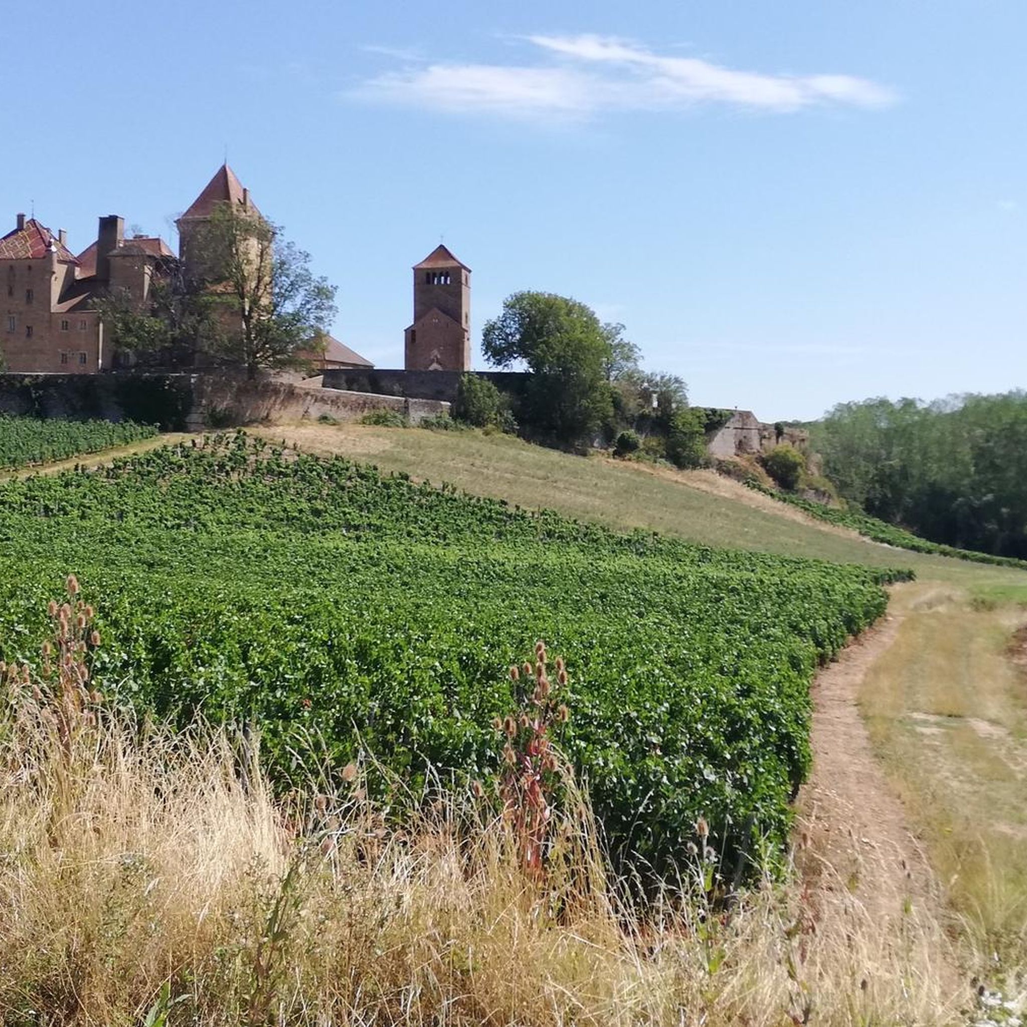
While specific trails may not pass directly by all, the wider area around Vaudebarrier is rich in historical sites. You might consider visiting Drée Castle or Montrouant Castle. For a unique sight, there's also the Miniature Eiffel Tower with Velociraptor. These attractions offer interesting diversions near the cycling routes.
Are the mountain bike trails around Vaudebarrier suitable for dogs?
While specific regulations for each trail can vary, the broader Bourgogne-Franche-Comté region generally welcomes dogs on trails, often requiring them to be on a leash. Given the natural, open character of the Vaudebarrier area with its meadows and woodlands, many trails are likely dog-friendly. It's always advisable to check local signage or specific route details for any restrictions.
Are there any circular mountain bike routes available?
Yes, many of the routes around Vaudebarrier are designed as loops, offering convenient circular journeys. Examples include the moderate Rest area by the stream – Arconce Bridge loop from Charolles, which is 35.8 km, and the Ford or Narrow Bridge loop from Changy, covering 25.9 km.
Where can I find parking for mountain biking in the Vaudebarrier area?
While specific parking spots for each trail are not detailed, Vaudebarrier is a village within the Charolais region. Parking is generally available in and around villages like Vaudebarrier, Charolles, or the starting points of specific routes. Look for designated parking areas or public spaces in these towns when planning your ride.
Are there any amenities like cafes or pubs near the mountain bike trails?
Vaudebarrier and nearby towns like Charolles are part of the Burgundy region, known for its charming villages. You can expect to find local cafes, restaurants, and pubs in these settlements, offering places to refuel and relax before or after your ride. It's recommended to check opening hours, especially in smaller villages.
What is the typical duration for mountain bike rides in this area?
The duration of rides varies depending on the trail's length and difficulty. For example, an easy route like the Bois des franchises loop from Changy takes about 1 hour 4 minutes, while a moderate trail such as the Ford or Narrow Bridge loop from Changy typically takes around 1 hour 53 minutes. More difficult routes, like the Mount St. Cyr – Mount Saint-Cyr loop from Verosvres, can take over 3 hours.
Most popular attractions around Vaudebarrier

Get inspired with the komoot mobile app


Explore more
Browse the best MTB trails in other regions.
