The best road cycling routes around Bourthes
4.8
(23)
848
riders
138
rides
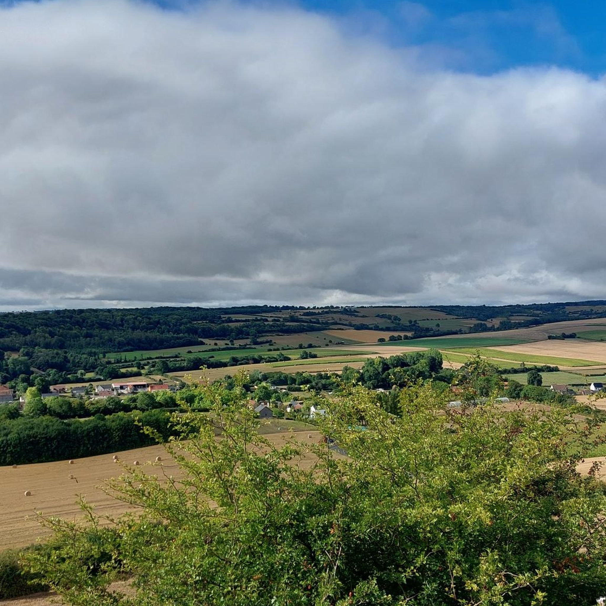
Road cycling routes around Bourthes are situated within the Parc naturel régional des caps et marais d'Opale, offering diverse landscapes for cyclists. The region features varied topography, including rolling countryside, farmlands, and forests, providing a range of cycling experiences. Routes can include coastal sections with views towards Les Deux-Caps, as well as inland paths traversing different elevations. The area provides mostly well-paved surfaces suitable for road cycling.
Best road cycling routes around Bourthes
- The most popular road cycling route is…
Last updated: May 22, 2026
4.5
(2)
38
riders
54.9km
02:26
360m
360m
Moderate road ride. Good fitness required. Some segments of this route may be unpaved and difficult to ride.
4.0
(1)
16
riders
36.7km
01:33
230m
230m
Easy road ride. Great for any fitness level. Mostly well-paved surfaces and easy to ride.

Sign up for free
6
riders
64.7km
02:43
400m
400m
Moderate road ride. Good fitness required. Mostly well-paved surfaces and easy to ride.
7
riders
57.6km
02:40
630m
630m
Moderate road ride. Good fitness required. Mostly well-paved surfaces and easy to ride.
5
riders
104km
04:43
1,080m
1,080m
Hard road ride. Very good fitness required. Mostly well-paved surfaces and easy to ride.
Get access to more routes and recommendations from other explorers.
Sign up for free
Already have an account?
Our route recommendations are based on thousands of hikes, rides, and runs completed by other people on komoot.
Start today with a free account
Your next adventure awaits.
Login or Signup



Tips from the Community

The Canche (Dutch: Kwinte) is a river in France, flowing through the Pas-de-Calais department in the Hauts-de-France region. It originates in the Ternois region, within the commune of Gouy-en-Ternois. Initially flowing southeast, it then turns northwest and, after approximately 100 kilometers, empties into the English Channel as an estuary north of Étaples and Le Touquet-Paris-Plage. Here, the Canche is strongly influenced by the tides. This results in significant fluctuations in the river's water level and the formation of extensive salt marshes.
0
0
The British military cemetery at Étaples is one of the largest British First World War cemeteries in France and is located near the town of Étaples in the Pas-de-Calais department. It contains over 11,000 Commonwealth graves from the First World War, in addition to Second World War graves and 658 German graves. The cemetery serves as a memorial to soldiers who died of their injuries or illnesses in the nearby British military hospitals and training camps.
0
0


It's a climb! Hang in there on this climb, not so long but intense at the end of Lille-Hardelot!
0
0

A real test of freshness for the legs or a signal to return home in the event of running out of fuel in the 12 to 13% range.
0
0

Excellent road between Coulomby and Quesques - quiet, smooth and superb wooded scenery.
1
0

This mill currently hosts a gîte.
1
0

Frequently Asked Questions
How many road cycling routes are available around Bourthes?
There are over 130 road cycling routes available around Bourthes, offering a wide variety of options for different preferences and skill levels.
What kind of terrain can I expect when road cycling near Bourthes?
The region around Bourthes, situated within the Parc naturel régional des caps et marais d'Opale, offers diverse terrain. You can expect varied topography including rolling countryside, farmlands, and forests. Some routes may feature coastal sections with views towards Les Deux-Caps, while others traverse inland paths with different elevations. Most surfaces are well-paved, ensuring a smooth road cycling experience.
What are the difficulty levels of road cycling routes in the Bourthes area?
Road cycling routes around Bourthes cater to a range of abilities. You'll find approximately 27 easy routes, 99 moderate routes, and 5 more challenging routes. Easy rides might have elevation gains up to 1,000 ft., while more challenging excursions can feature over 3,000 ft. of climbing.
What do other cyclists say about road cycling in Bourthes?
The road cycling routes around Bourthes are highly rated by the komoot community, with an average score of 4.7 stars from over 30 reviews. Cyclists often praise the varied terrain, green rural scenery, and the options available for different ability levels.
Are there any specific landmarks or points of interest along the road cycling routes?
Yes, several routes pass by interesting landmarks. For instance, the Le Touquet Covered Market – Citadel of Montreuil loop from Hucqueliers leads through areas with notable sites like the Citadel of Montreuil. Other attractions in the wider area include the Beussent Chocolaterie and the Saint-Wulmer Church, Parenty.
When is the best time of year to go road cycling in Bourthes?
The region's natural beauty can be enjoyed throughout much of the year. Spring and autumn generally offer pleasant temperatures and vibrant scenery, making them ideal for road cycling. Summer provides longer daylight hours, though it can be warmer. It's always advisable to check local weather forecasts before heading out.
Are there family-friendly road cycling routes in the Bourthes area?
Yes, there are several easy road cycling routes suitable for families. These routes typically feature lower elevation gains and mostly well-paved surfaces, allowing for a more relaxed and enjoyable ride for all ages. Look for routes marked as 'easy' on komoot for suitable options.
Are there circular road cycling routes available around Bourthes?
Many of the road cycling routes around Bourthes are designed as loops, allowing you to start and finish at the same point. An example is The Renty water mill – Wooded Path in the Prés d'Ouve loop from Bourthes, which offers a scenic circular ride.
Can I find long-distance road cycling routes near Bourthes?
Yes, Bourthes serves as a great starting point for longer road cycling adventures. Routes like the Citadel of Montreuil-sur-Mer – Citadel of Montreuil loop from Hucqueliers, at over 77 km, provide a substantial challenge for those looking for extended rides.
Is it easy to find parking for road cycling routes in Bourthes?
Bourthes and its surrounding villages often have public parking areas available, especially near town centers or trailheads, making it convenient to access the road cycling routes. Specific parking details can often be found in the route descriptions on komoot.
What natural features can I see while road cycling around Bourthes?
Road cycling around Bourthes offers a 'wild wonderland' of natural beauty. You can experience diverse landscapes including rolling countryside, farmlands, and forests. The region is also close to the spectacular headlands of Les Deux-Caps (Cap Gris-Nez and Cap Blanc-Nez), offering breathtaking panoramic views and coastal formations if your route extends towards the coast.
Most popular attractions around Bourthes

Get inspired with the komoot mobile app


Explore more
Browse the best Road cycling routes in other regions.
